A message on behalf of the HOTOSM humanitarian mapper team in response to the crisis in Nepal – This message comes via way of the OSM-Colorado Group
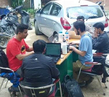
OSM Contributors at Kathmandu Living Labs operational one day after the earthquake. They support the government and international organizations from Kathmandu while the Global OSM community remotely revise quickly the OpenStreetMap. (Source: OSM Wiki)
Greetings OSM-Colorado,
I try to limit my ‘shameless’ plugs for the Humanitarian OpenStreetMap Team, but after today’s news of another major earthquake to hit Nepal; we need all the help we can get. For general information on the response and what we are doing, visit: http://wiki.openstreetmap.org/
wiki/2015_Nepal_earthquake I think the biggest need right now if for more experienced mappers to quickly knock out the more difficult tasks as well as validate, as I think the numbers are showing several thousand new OSM contributors participating via the Tasking Manager: http://tasks.hotosm.org/
If you can lend a hand, it would surely be appreciated.
Sourced from Russ Deffner, OSM Colorado