GIS user technology news

News, Business, AI, Technology, IOS, Android, Google, Mobile, GIS, Crypto Currency, Economics

  • Advertising & Sponsored Posts
    • Advertising & Sponsored Posts
    • Submit Press
  • PRESS
    • Submit PR
    • Top Press
    • Business
    • Software
    • Hardware
    • UAV News
    • Mobile Technology
  • FEATURES
    • Around the Web
    • Social Media Features
    • EXPERTS & Guests
    • Tips
    • Infographics
  • Blog
  • Events
  • Shop
  • Tradepubs
  • CAREERS
You are here: Home / * PRESS / DATA / Data Visualization Recognizes Canada’s Open Data Portals and a Move Towards #OpenGov

Data Visualization Recognizes Canada’s Open Data Portals and a Move Towards #OpenGov

April 8, 2015 By GISuser

CloverPoint, a leader in land management consulting, GIS, mapping, and land management software publishes Infographic recognizing Canada’s leading open data resources.
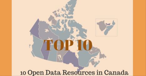
Open Data Infographic - 10 Open Data Resources in Canada

Open Data Infographic – 10 Open Data Resources in Canada

April 8, 2015 – British Columbia, Canada — Developers, mapping professionals, GEO tech consultants, mashup artists, Geogeek hackers, and others are constantly on the hunt for data, ideally “Open Data” to add context and value to apps. In Canada there are a number of Provincial OpenData portals providing open, public access to a variety of data products, spatial data layers, tools, APIs and other useful resources. Sadly there really isn’t a consistent method for archival and maintenance of such data resources, each Province seemingly developing their own gateway or portal for hosting data while data themes and formats available vary from Province to Province. We’ve identified the following 10 resources as a starting point for anyone seeking data in Canada.

We’re pleased to share a “TOP 10″ style list of Open Data resources in Canada. These fine, open resources provide a gateway to developers, citizens, and the community, enabling them to create useful maps, apps, reports, and other data driven information tools. Below you’ll find our Open Data Canada Infographic sharing 10 must-bookmark Canadian data portals serving up data for your maps and apps.

The Top resources recognized in the infographic include:

– The GeoNOVA Portal is the Province of Nova Scotia’s gateway to geographic information

– Government of PEI GIS Data Layers

– Newfoundland & Labrador Open Data portal

– GeoNB gateway to geo information

– Open Data portal for Ontario

– Quebec Open Data portal

– Manitoba land initiative

– OpenDataSK portal

– The Alberta open data portal

– OpenData BC from DataBC

View the infographic HERE

About CloverPoint

CloverPoint (est. 1992) started as a cartographic company 20 years ago and is now an industry leading full services mapping company, delivering location based software and services around the globe. CloverPoint provides land management solutions to progressive organizations. Our mission is to simplify the connection between people, technology and their environment. We believe that everyone should be empowered to realize the full potential of their lands. We do this by making it easy for people to organize, discover and share their information. See http://cloverpoint.com and on Twitter @CloverPointVic

About Insight

Insight™ by CloverPoint is a system for maintaining records to aid in land title and facilities management. It provides a secure environment for storing and accessing information in order to support users and their need to make informed decisions on activities that may impact their land and resources. Insight is unique in its ability to collect information from multiple sources and share it with users based on their roles within the system. Insight™ is being used across North America by planning departments, local governments, engineers, architects, and first nations.  See more at http://cloverpoint.com/insight/

Check out this “TOP 10″ style list of Open Data resources in Canada http://t.co/0kvtPzp6FG #infographic #opengov pic.twitter.com/tJt3indbEP

— CloverPoint (@cloverpointvic) April 8, 2015


Filed Under: DATA, Government & OpenGov, Top Press Tagged With: Canada, Data, opendata, OpenGov

Top Press

The Global Expansion of Aueshah: A New Era of High Jewelry

April 11, 2026 By GISuser

KARACHI, PAKISTAN. The international luxury market is experiencing a profound shift. Consumers are increasingly rejecting mass-produced goods in favor of rarity, authenticity, and emotional depth. … [Read More...]

State of Data Science Report – AI and Open Source at Work

September 10, 2025 By GISuser

AI and Open Source at Work … [Read More...]

Topcon Announces Landmark Expansion of Topnet Live Network Across USA

January 26, 2025 By GISuser

LIVERMORE, Calif.---Topcon Positioning Systems has announced a significant expansion of its Topnet Live reference station network, introducing 200 new geodetic stations strategically positioned across … [Read More...]

Space Flight Laboratory (SFL) Announces Launch and Deployment of NorSat-4 Maritime Monitoring Microsatellite

January 19, 2025 By GISuser

Seventh Satellite Developed by SFL for Norway … [Read More...]

HERE and BMW Group extend partnership on AI-powered mapping system

January 8, 2025 By GISuser

HERE and BMW Group extend partnership on AI-powered mapping system for automated driving and enhanced road safety … [Read More...]

SFL Missions Inc. Confirms Successful Deployment of Six HawkEye 360 Radio Frequency Detection Satellites with Advanced Capabilities

October 27, 2026 By GISuser

MĀHIA, New Zealand, 26 October 2026 – SFL Missions Inc. today confirmed the successful deployment of six radio frequency (RF) detection and geolocation satellites for HawkEye 360 … [Read More...]

Canadian-Built RoadEng 12 Uses AI to Find the Best Location for New Resource and Rural Roads

October 17, 2026 By GISuser

Vancouver, BC, Canada, October 15, 2026 – North Vancouver-based Softree Technical Systems today released RoadEng Version 12, used in more than 75 countries to locate and design … [Read More...]

Beyond the Map: How AI Image and Video Generation Is Changing Geospatial Communication

October 14, 2026 By GISuser

Ask anyone who has shipped a GIS project what the hardest part was, and the answer is rarely the spatial analysis. It is almost always the communication. A site suitability … [Read More...]

From Maternity to Everyday Wear: Building a Wardrobe That Grows With You

October 14, 2026 By GISuser

When I think about maternity clothing, I feel the biggest mistake is buying too many things at once. During pregnancy, your body keeps changing, and something that fits well today … [Read More...]

eMMC 5.1 Explained: Features, Performance, and Applications in Modern Devices

October 14, 2026 By GISuser

Storage technology is an essential part of modern computing, influencing how devices store information, launch applications, and manage everyday workloads. Although … [Read More...]

Copyright gletham Communications 2015 - 2026

Go to mobile version