Recall, not long ago we shared a short spotlight on Tools to Help You Work Better, Smarter and Faster with LiDAR – this was a casual list of several products and tools that those interested in working with LiDAR data might find useful. Building on this list, we now share 5 more tools that professionals working with, or having a need to work with, LiDAR data should consider. Recall, LiDARmag.com is THE suggested resource dedicated to all things LiDAR
What is LiDAR? LiDAR technology uses waves typically in the visible, ultraviolet and infrared range. This technology enables direct measurement of 3D structures and underlying terrain with high resolution and high data accuracy
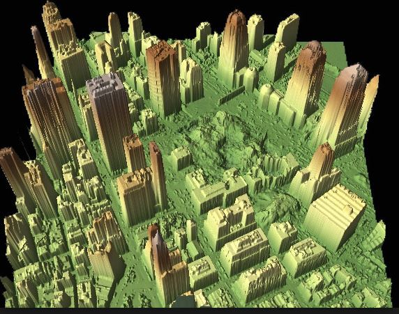
LiDAR scene of Ground Zero (Credit: NOAA)
5 Solutions for Working With LiDAR
According to the developer, this product suite is used heavily used in the commercial sector, government agencies, research labs, and educational institutions alike for filtering, tiling, rasterizing, triangulating, converting, clipping, quality-checking, etc… LAStools is a collection of highly-efficient, scriptable tools with multi-core batching that process LAS, compressed LAZ, Terrasolid BIN, ESRI Shapefiles, and ASCII. Note, the company also an has open-source LiDAR compressor tool (award winning) called LASzip for those with a need for compressed LiDAR. On Twitter see @rapidlasso
Developed by OGSystems,this is a LiDAR viewing app for android and iOS. The app is available for free on the Google play store and apple iTunes app store. With the app, users can not only view but also manipulate either their own point clouds or download existing data provided by OGSystems servers. They also offer a service to store and deploy your data over the cloud for quick dissemination. On Twitter see @ogsystems
TerraSolid for processing LiDAR data
Terrasolid develops software products that are used for processing LiDAR and image data from airborne and mobile laser scanning systems. TerraSolid products are able to use the pointclouds in a geospatial setting. On Twitter see @3DLaserMapping
Software for working with and extracting featured from LiDAR data. Solutions include TopoDot for point cloud data processing, TopoLift to support your laser scanning, and TopoPlanner & TopoMission, free apps to help plan, estimate and manage your scanning projects. On Twitter see @Certainty3D
The Merrick Advanced Remote Sensing (MARS®) software suite is a comprehensive, production-grade Windows application designed to visualize, manage, process and analyze LiDAR point cloud data. The MARS suite includes MARS FreeView (basic LiDAR visualization), MARS Explorer (LiDAR data classification and processing), MARS Explorer QC (automated feature processing), and MARS Production for advanced processing and more. On Twitter see @Merrick_MARS
[Tweet “5 More Solutions for Working With LiDAR @rapidlasso @3DLaserMapping @Certainty3D @Merrick_MARS @ogsystems“]
See Also:
- Tools to Help You Work Better, Smarter and Faster with LiDAR
- LiDAR Market – Global Industry Analysis, Size, Share, Growth, Trends and Forecast 2014 – 2020
- more LiDAR solutions in this GISuser archive
What tools are using working with to process your LiDAR data?