The power of GIS as a tool to help manage our planet’s natural resources is limited only by the insightfulness of our questions. Fortunately, more timely and detailed data becomes available every year, so we are free to ask an ever-wider range of questions, such as:
- In relation to agriculture, what factors affect our ability to sustainably produce crops, and how do these factors change across the landscape?
- Where should agriculture expand, and where should it retract?
Blue Raster, along with partners World Resources Institute (WRI) and Sekala, has developed an interactive web application allowing users to customize criteria for sustainable agriculture and find sites for sustainable palm oil across Indonesia.
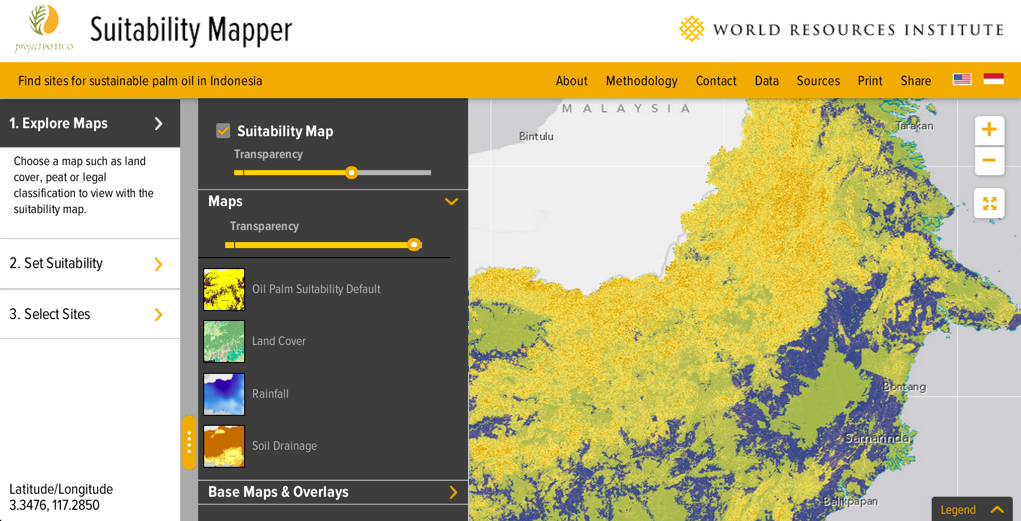
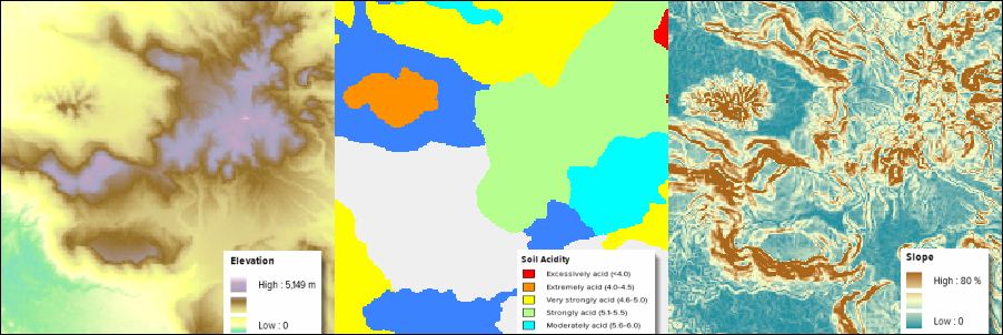
Upon entering the Suitability Mapper, users visualize various layers superimposed on the Indonesian landscape including elevation, hill slope, rainfall, and soil acidity. WRI provides a two-color layer showing the distribution of areas deemed “potentially suitable” (purple) and “unsuitable” (yellow) for sustainable palm oil production.
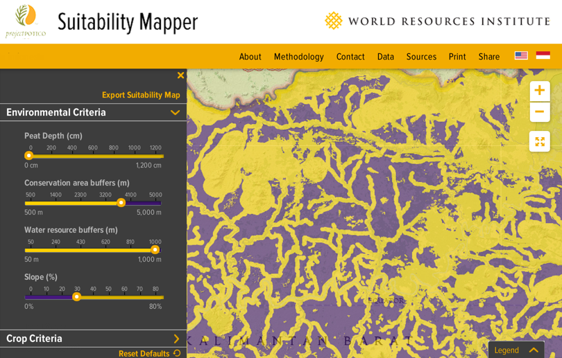
Taking analysis a step further, the user can adjust the criteria for this suitability layer by adjusting controls linked to each palm oil variable. In the screenshot below, I have adjusted the suitability analysis to increase the mandatory distance from conservation areas and water resources. With my custom analysis complete, I can use drawing tools to summarize the results for a specific area. Results include the area’s legal status, amount of suitable area, distance from nearby roads, legal status, and whether an oil palm concession already exists in the location.
The Suitability Mapper was built on top of Esri’s ArcGIS Server and ArcGIS API for JavaScript. Using the Image Extension for ArcGIS Server, we are able to analyze and compute accurate suitability maps in realtime based on user-supplied criteria. Instead of investing large amounts of time in software development and maintenance, we were able to use the out-of-the-box features of Esri’s Image Extension for ArcGIS Server to achieve the goals of the project. This platform will also make it easier to add more and better data as it becomes available, to continually improve our analysis, inform key stakeholders, and make better decisions.
Suitability Mapper is part of the Global Forest Watch platform which has many new features coming soon with the launch of its Commodities analysis tool. Stay tuned for more information and launch dates soon
Source: http://www.blueraster.com/