After recently attending my 15th consecutive International Esri User Conference (ESRIUC), I figured a good place to start as I pour over my notes, scribbles, emails, etc… would be the closing session! This mainly because it’s still fresh in my mind and many attendees miss out on the session by not being able to stay in San Diego through Friday. And so, a short recap of the ESRIUC closing session – note, I’ll be following this up with more summaries and short features from the conference.
For more than 10 years now I typically have left the ESRIUC on Friday morning, however, in recent years I started extending my UC week a little so I could enjoy the full conference experience. Staying a little longer meant I could enjoy the Friday closing summary session with Jack Dangermond and his top brass on stage. For those of you who’ve never stuck around through Friday you really are missing out! The closing session is a more casual Jack and crew, recapping the week and Dangermond being very direct on stage. This year was no different as Dangermond used the session as an opportunity to explain the main points that he hoped attendees understood – he also used the session to ask for affirmation and feedback. The session wound down with a Q and A from the audience – I was pleased to have been selected to ask the first question also!
To recap
The first portion of the session was reserved for award winners as Dangermond recognized all those groups and individuals who chosen to receive awards for excellence in the field for their outstanding contributions. Some of the award winners this year in various categories included: the USDA, PACI Kuwait, Blue Raster and more. It was also a chance to see and hear about the winners of the map gallery awards – see some photos of the Map Gallery in this Album. As always the maps were simply awesome and you’ll see them all in next years Map Book which you will likely receive, as always, in your UC goodie bag when you show up in 2014 to enjoy the week. Maps receiving recognition came from all of the World from the likes of USFS, CSU, U of Washington, and Banning High School. The map book is always available for sale online via Esri press… In have the last 15 in my collection so I’m needing a bigger coffee table! A couple of very interesting maps that were recognized included a map with crossword puzzle, and a map cartographically styled on the work of Vincent Van Gogh… Both were Quite impressive and poster worthy I’d have to say! Dangermond then went on to describe what he felt were some of the key messages that he and his Esri staffers put forward during the week, asking for validation to ensure that those of us in attendance agreed.
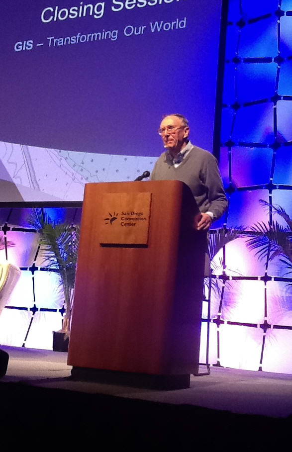
Esri President, Jack Dangermond at ESRIUC closing session
Some of the Key messages from the 2013 UC closing:
- Technology supports multiple platforms and environments
- GIS is being transformed into a web GIS
- ArcGIS is a web GIS!
- It’s integrated and will become more easy… Is It open? Yes, and it will become more open with open APIs, support for standards, a growing as a. strong platform with increasingly more services.
- ArcGIS supports enterprise integration… Makes you stronger for your patterns of work, amplify out and make your content available to others… Making mapping and GIS more available over the organization.
- Is your work that simple? No but it needs to look simple and this is how ArcGIS is evolving
- The role of GIS is transforming and the role of GIS is expanding
I found it quite interesting that Dangermond went on at great length describing ArcGIS licensing in order to ensure that everyone understood what they would get, whether an individual license holder or enterprise user. There was also an effort to describe what the new "Pro" offering is although it seemed to me that many in the crowd and online via social media are still left wondering, what exactly is ArcGIS Pro? Stay tuned for more to come on this…
Dangermond provided the following answers to common ArcGIS license questions:
- Users with a desktop license get 1 subscription with 1 named user
- A user with 3 desktop licenses get one subscription AGOL with 3 named users
- A user with 2 customer numbers each with 3 desktop licenses would get 2 AGOL subscriptions with 3 named users in each
- Users don’t need to request an AGOL subscription, they will receive notification within the next 60 days
- What does portal give me? One premise deployment, web publishing, new apps, feed in additional content, access from multiple clients Esri is addressing and Moving towards open source… "We’re going all out in this space"
- Why use ArcGIS Portal? This is suggested only for those who have strict security requirements
- Users with an advanced server license receive a license to Portal for ArcGIS for their org
- Note, Esri strongly suggests that orgs not install Portal themselves, rather, it is recommended that Esri assist you.
- NGOs are supported with special almost free software, simply pay associated costs… They get software.
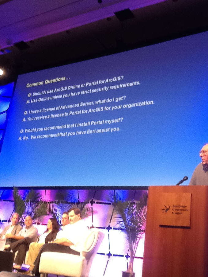
Dangermond responding to common questions
Content, online services, subscriptions. Interesting to note that Dangermond commented that "Over a quarter of our software is running at NGOs". See more at Esri.com/nonprofit
Product Highlights in ArcGIS at 10.2:
- Improvements in analytics, imagery, 3D and more
- All desktop users get an online subscription
- New apps… Data collector, explorer,dashboard.. Enforcing the concept of web GIS apps
- Your extending the desktop pattern with these other capabilities
- What do I get with a desktop license… You get one subscription for one named user
- Pro… Will run side by side with your 10x and is part of the desktop license
- The new explorer app.. Some people complained about the name but too bad! Lol
- 64 bit is the biggest announcement this week!
- 10.2 is coming in 2 weeks
Some key Takeaways:
- People want to go home and help. Where to start? Orgs can use your time and your data!
- Esri wants to partner with business users and partners
- Security and protection Esri and you – A chief security and compliance officer in place. Stop and detect intrusion efforts. Esri is the biggest user of our own software…
- It’s all one system.. These are no longer isolated components. They feed each other and your license determines what you get and use

Overall, I’d have to say that the most important things that Dangermond would like people to take away from ESRIUC is that GIS is transforming into a web GIS, 64 bit support is BIG and users should get involved
See Also the following:
What did you take away from this year’s ESRIUC or what questions do you have still? What was hot and exciting for you this year or what wasn’t? Ping me vvia email editor at gisuser.com of on twitter @gletham