GIS user technology news

News, Business, AI, Technology, IOS, Android, Google, Mobile, GIS, Crypto Currency, Economics

  • Advertising & Sponsored Posts
    • Advertising & Sponsored Posts
    • Submit Press
  • PRESS
    • Submit PR
    • Top Press
    • Business
    • Software
    • Hardware
    • UAV News
    • Mobile Technology
  • FEATURES
    • Around the Web
    • Social Media Features
    • EXPERTS & Guests
    • Tips
    • Infographics
  • Blog
  • Events
  • Shop
  • Tradepubs
  • CAREERS
You are here: Home / News / Public Safety and Emergency Response / NOAA releases aerial imagery of Tuscaloosa, Ala. tornado damage

NOAA releases aerial imagery of Tuscaloosa, Ala. tornado damage

May 3, 2011 By Editor

NOAA’s National Geodetic Survey dispatched the NOAA King Air 350CER aircraft, equipped with specialized remote sensing equipment, on a mission to collect aerial photography at 5,000 feet from Tuscaloosa to Birmingham, Ala.

These "before and after" shots show damage caused by last week’s tornado near 15th Street and McFarland Boulevard in Tuscaloosa.

Photos will be used to assist federal and local officials in response and recovery efforts.

All images from NOAA flights are being posted on this public website.

Hi-Res images available online.

For more information, contact: John Ewald, john.ewald@noaa.gov, 240-429-6127.

NOAA’s mission is to understand and predict changes in the Earth’s environment, from the depths of the ocean to the surface of the sun, and to conserve and manage our coastal and marine resources. Visit us on Facebook.

NOAA image Tuscaloosa Alabama 

Before and after imagery depicting tornado damage in the vicinity of the intersection of 15th St. E. and McFarland Blvd. E. in southeast Tuscaloosa, AL. The before imagery is courtesy of Google, the after imagery was acquired from an altitude of 5,000 feet above ground level by the NOAA King Air April 29, 2011. (Image Credit: NOAA Hi-Res images available online.) 


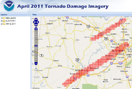
See more imagery: http://ngs.woc.noaa.gov/storms/apr11_tornado/

Filed Under: Public Safety and Emergency Response Tagged With: Ala. tornado damage, News, NOAA releases aerial imagery of Tuscaloosa, Public Safety and Emergency Response

Editor’s Picks

Free Data from USGS Proves Its Worth for Observing Earth

Data Tip – Customized Coverage from LandScan Global Population Database

CoreLogic Data Reveals Wildfires Pose Big Risk to Nearly 900,000 Western US Homes in 2015

Real Earth™ Wins Microsoft Competition for 3D Mapping and Localization

See More Editor's Picks...

About Editor

Glenn is a geographer and a GIS professional with over 20 years experience in the industry. He's the co-founder of GISuser and several other technology web publications.

Recent Industry News

The Drift Between Early Notes and Final Case Files in Abuse-Related Legal Support

April 29, 2026 By GISuser

Aerial Surveys Int’l and Global Marketing Insights to Present GEOINT 2026 Workshop on Multi-Domain Geospatial Fusion for Automated Infrastructure Monitoring

April 24, 2026 By GISuser

Why Timing Matters More Than You Think With Spray Seal (And Why People Often Get It Slightly Wrong)

April 22, 2026 By GISuser

The Quiet Planning Stage Most People Don’t See When Building a Pool in Brisbane

April 22, 2026 By GISuser

Hot News

State of Data Science Report – AI and Open Source at Work

HERE and AWS Collaborate on New HERE AI Mapping Solutions

Virtual Surveyor Adds Productivity Tools to Mid-Level Smart Drone Surveying Software Plan

Categories

Copyright gletham Communications 2015 - 2026

Go to mobile version