GIS user technology news

News, Business, AI, Technology, IOS, Android, Google, Mobile, GIS, Crypto Currency, Economics

  • Advertising & Sponsored Posts
    • Advertising & Sponsored Posts
    • Submit Press
  • PRESS
    • Submit PR
    • Top Press
    • Business
    • Software
    • Hardware
    • UAV News
    • Mobile Technology
  • FEATURES
    • Around the Web
    • Social Media Features
    • EXPERTS & Guests
    • Tips
    • Infographics
  • Around the Web
  • Events
  • Shop
  • Tradepubs
  • CAREERS
You are here: Home / * PRESS / Business / Michigan Center for Geographic Information

Michigan Center for Geographic Information

January 19, 2005 By GISuser

MCGI offers visitors some very interesting geospatial resources including access to a map gallery, data library, MI Mapper, and information from the Michigan homeland security committee. For geospatial data or anything else GIS related in Michigan this is a fine resource and a must visit.

Mission

The Center’s mission will enable state government to more effectively and efficiently serve the citizens, businesses and other governments of the state in areas of public protection, homeland security, economic development, environmental protection and transportation.
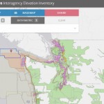
Data Library

Serves as the state’s repository of digital geographic information. This site currently contains over 60 unique statewide datasets including the state’s basemap (MI Geographic Framework), aerial imagery, geology, hydrography, land ownership, topography, and much more. Please visit often as geographic information from across state government will continually be made available and updated through this portal – See http://www.mcgi.state.mi.us/mgdl/ – Searchable by geography, theme, or meta data.

Map Michigan

Map Michigan offers a variety of geographic search options. Information to be displayed ranges from specified addresses, planning a route, street intersections, coordinates, zip codes, points of interest and specialized maps. Points of Interest maps are user-specified features, such as business services, education locations, governmental facilities, travel and recreation locations, and more. Specialized maps consist of items such as schools, boat launches and waterfalls.

http://www.michigan.gov/cgi/

Filed Under: Business

Editor’s Picks

Data Tip - The US Interagency Elevation Inventory

Data Tip – The US Interagency Elevation Inventory

Arkansas.gov Ranks Among Top 3 Government Websites

DigitalGlobe Top Images from 2014 – The fourth annual Top Image contest

Social Guide – The Definitive Starting Point for Mastering your Twitter Analytics

See More Editor's Picks...

Recent Posts

  • Understanding the Legal Requirements for Energy Compliance
  • Why Expert Treatment Matters for Delicate and Hand-Woven Rugs
  • Why Annual Checks on Heating Equipment Are Crucial for Tenant Protection
  • How Do You Choose the Right Wedding Sparklers Based on Size, Style, and Send-Off Timing?
  • Best Forex Cards with Zero Markup Fees for Indian Students Studying Abroad in 2025
  • Why a B2B Contact Database Is Useful for Modern Businesses
  • Tongits Card Game sa Pilipinas: Gabay sa Online Gameplay sa GameZone
  • Salary Calculator: A Complete Guide to Understanding Your True Take-Home Pay in 2025
  • Pocket Option Risk Management Tools: Building Smarter, Safer Trading Habits
  • GeoAI Is Getting Smarter — But GIS Teams Still Struggle to Show the Story

Recent Features

Space Flight Laboratory (SFL) Announces Successful Launch & Deployment of HawkEye 360’s Cluster 11

FOSS4G NA 2024: The Premier Open Source Geospatial Conference Returns to St. Louis, September 9-11

Photographer Touch Reveal the Top Cameras, Lenses, and Photo Editing Tools of 2022

Digitalization and Simulation at the North Pole

Natural Gas District & GIS-Centric Asset Management

More Posts from this Category

Categories

RSS Career Tips

  • Four Characteristics of the Best Virtual Employees
  • 28 Tools to Conquer the Social Media Recruiting World
  • 8 Questions Employers Should Ask About Coronavirus
  • Jobcase Launches Free Unemployment Resource Center for Workers Impacted by COVID-19
  • Must-Have Gadgets and Technology for the Remote Office Worker


featured podcast

RSS Tech pubs

  • From Contact Center to Connected Experience
  • How to build a virtual agent your customers want to use
  • How to build a virtual agent your customers want to use

RSS Computers

  • How the Cloud is Reshaping Virtual Desktops
  • Millennials as Brand Advocates - New Research Study Results
  • Vehicles Best Practices Installation Guide

RSS HR Tips

  • AWS GovCloud (US) Celebrates 10th Anniversary and a Decade of Digital Transformation in the Federal Government
  • Exploring the Impact of COVID-19 on Customer Behavior
  • The Pivot to 100% Remote Training in the Contact Center

RSS Gov Tech

  • 10 Legal Jobs You Can Get Without a Law Degree
  • J.D. Power Examines How the Inflation Reduction Act Reshapes EV Landscape
  • Making Telehealth Work for You: The Ultimate Guide

Copyright Spatial Media LLC 2003 - 2015

Go to mobile version