
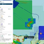
Vaughan, Ontario, CANADA – May 13, 2025 — Teledyne Geospatial is excited to announce its participation in the SeaSEC Challenge Weeks, taking place from May 12 to 23, 2025. Hosted by The Netherlands, this event will showcase cutting-edge technology at SeaSEC’s maritime testing grounds off the coast of Scheveningen. This bold initiative pushes the industry to […]
Teledyne Geospatial to present an exclusive preview of its new coastal mapping solution at HYDRO 2024

Vaughan, CANADA – October 31, 2024 – Teledyne Geospatial will showcase an array of their latest advancements in ocean mapping hardware and software solutions at HYDRO 2024, in Rostock-Warnemünde, Germany, November 5-7. At booth 91, Teledyne Geospatial will introduce Fathom, the market’s fastest and most intuitive coastal mapping solution. Fathom is comprised of a lidar sensor for deep […]
Teledyne launches CARIS Cloud to support S-100 production
Fredericton, NB, CANADA, April 27: Teledyne Geospatial, a Teledyne Technologies company, is pleased to announce the release of three new applications on its CARIS Cloud platform—the CARIS Bathy Data Service, S-57 ENC Service, and Chart Data Service.
Teledyne Geospatial to exhibit and present at Geo Week 2023
Visit Teledyne Geospatial at GeoWeek to learn more about a innovative new Galaxy product
Teledyne expands its Genie Nano portfolio with new 10GigE cameras
New series includes industry’s smallest 67 MP camera for high-performance image capture
Teledyne announces new Ladybug6 cameras for high accuracy 360-degree spherical image capture

Richmond, CANADA ─ October 17, 2022 ─ Teledyne FLIR Integrated Imaging Solutions is pleased to announce the all new Ladybug6— the latest addition to its field proven Ladybug series. Ladybug6 is the leading high-resolution camera designed to capture 360-degree spherical images from moving platforms in all-weather conditions. Its industrial grade design and out-of-the-box factory calibration produces 72 […]
Teledyne introduces Contact Image Sensors for high-speed, high-resolution line scan imaging
WATERLOO, Ontario, Sept. 27, 2022 (GLOBE NEWSWIRE) — Teledyne DALSA is pleased to introduce AxCIS™, a new family of high-speed and high-resolution fully integrated line scan imaging modules. These easy-to-use Contact Image Sensors (CIS) combine sensors, lenses, and lights all-in-one, offering a lower cost inspection system for many demanding machine vision applications.
Teledyne announces next generation 5GigE area scan camera platform
New Vizor camera platform brings together Teledyne’s vision expertise and customer knowledge in a new camera family
Teledyne’s new high-resolution multispectral line scan camera extends defect detection beyond the surface
Teledyne DALSA introduces its Linea ML 8k multispectral CLHS line scan camera for improved defect detectability with a single scan
Teledyne Geospatial wins 2021 MAPPS ‘Project of the Year Grand Award’ and the ‘Technology Innovation Award’

Vaughan, Ontario, CANADA – February 9, 2022 – Teledyne Geospatial, a Teledyne Technologies [NYSE:TDY] company, is pleased to announce that the next generation Optech CZMIL SuperNova topo/bathy lidar system has been awarded both the Geospatial Excellence Award for Technology Innovation and the Geospatial Excellence – Project of the Year Grand Award.