DataNumen has released DataNumen DWG Recovery, a Windows application that repairs corrupted or damaged DWG files created by AutoCAD, AutoCAD LT and similar software products. Improvements in version 1.1 include supports to recover files in formats from AutoCAD Release 2004 through 2006. DataNumen DWG Recovery can fix more than 50 types of objects in DWG […]
SuperGIS 3D Earth Server 3.2 Officially Launched
Supergeo Technologies, the leading global provider of complete GIS software and solutions, officially released SuperGIS 3D Earth Server 3.2, to assist enterprises in managing, integrating, publishing and displaying geographic data and 3D models in an innovative way. SuperGIS 3D Earth Server 3.2 is the GIS software designed to publish and overlay terrain data, 3D models […]
Australia Seeking proposals for joint private-public projects using big data
As outlined in the APS Big Data Strategy, I would like to invite agencies, researchers and the private sector to submit proposals for joint private-public projects using big data in innovative ways. We are seeking proposals for projects that would increase the efficiency of government services or deliver service improvements. Proposals will initially be assessed […]
IDV Solutions Updates Visual Command Center – Enterprise Risk Visualization Software
New version 3.1 delivers enhancement to weather, social media visualization
Blue Marble Releases GeoCalc 7.0 with EPSG “Area of Use” Polygon Data
Hallowell, Maine – April 2, 2014 – Blue Marble Geographics (bluemarblegeo.com) is pleased to announce the release of the GeoCalc 7.0 software development kit (SDK). This release features new functionality to display and utilize the EPSG “Area of Use” Polygon dataset, improved Vertical Coordinate system handling, and new and improved Dominion Land Survey classes now […]
Orbit GT releases iOS Mobile Mapping viewer 10.5
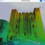
Lokeren, Belgium, March 31st, 2014. Orbit GeoSpatial Technologies releases a great update to the free iOS PanoViewer App, version 10.5 “This update again brings new features to the mobile users”, says Peter Bonne, VP Business Development and Senior Product Manager at Orbit GT. “As the Orbit MM Publisher offers point cloud visualization, the iOS App […]
Trimble Launches New Version of its eCognition Software for Advanced Geospatial Data Analysis
LOUISVILLE, Ky., March 28, 2014—Trimble (NASDAQ: TRMB) announced today the latest version of its eCognition® software for geospatial data analysis at the American Society for Photogrammetry and Remote Sensing (ASPRS) conference. Trimble eCognition software is a powerful solution for the analysis and extraction of information from geospatial data collected via aerial, satellite and mobile mapping […]
US Navy sources sought notice request for information (RFI) Geospatial Intelligence Software
This sources sought notice is a request for information (RFI) for acquisition planning purposes only. This is not a request for proposals, proposal abstracts, quotations or obligation on the part of the Government to acquire any products or services. This RFI is for market research purposes only to gain knowledge of potential qualified sources […]
New Autodesk 2015 Design Suites Drive Unsurpassed Value for Subscribers
Expanding Portfolio Combines Tighter Integration with Autodesk 360 Cloud Services & Powerful AutoCAD Enhancements with Convenient, Flexible Subscription Options
GfK releases 2014 version of geomarketi ng software RegioGraph
The latest version of GfK’s geomarketing software "RegioGraph 2014" allows users to plan multi-level sales channels and display international address data at the street-segment level. RegioGraph’s comprehensive reporting options make it easy to share insights on untapped potential in markets, sales territories and regions of interest. The new version of RegioGraph includes maps and purchasing […]