GIS user technology news

News, Business, AI, Technology, IOS, Android, Google, Mobile, GIS, Crypto Currency, Economics

  • Advertising & Sponsored Posts
    • Advertising & Sponsored Posts
    • Submit Press
  • PRESS
    • Submit PR
    • Top Press
    • Business
    • Software
    • Hardware
    • UAV News
    • Mobile Technology
  • FEATURES
    • Around the Web
    • Social Media Features
    • EXPERTS & Guests
    • Tips
    • Infographics
  • Blog
  • Events
  • Shop
  • Tradepubs
  • CAREERS
You are here: Home / Archives for Geo Tech Software

Trimble Announces New Software Updates to Simplify Geospatial Analysis and Modeling

April 15, 2014 By Editor

Advanced Productivity When Working with Images and Scan Data

Filed Under: GIS, Geo Tech Software Tagged With: Geo Tech Software, GIS, News, Trimble Announces New Software Updates to Simplify Geospatial Analysis and Modeling

Trimble Delivers 3D Scanning Extension for SketchUp

April 15, 2014 By Editor

New Tool Allows Easy Creation of Visual 3D Models from Real-World Scanning Data

Filed Under: GIS, Geo Tech Software Tagged With: Geo Tech Software, GIS, News, Trimble Delivers 3D Scanning Extension for SketchUp

exactEarth and SRT Announce New Small Vessel Tracking Technology

April 14, 2014 By Editor

Cambridge, ON – April 14, 2014 –exactEarth Ltd. is pleased to announce that it has concluded a mutually exclusive agreement with SRT plc (SRT), to develop and commercialise technology that will for the first time enable low power AIS transceivers of the types being deployed on small commercial and leisure vessels worldwide to be tracked from […]

Filed Under: GIS, Geo Tech Software Tagged With: exactEarth and SRT Announce New Small Vessel Tracking Technology, Geo Tech Software, GIS, News

DataNumen DWG Recovery Software Repairs Damaged AutoCAD DWG Files

April 9, 2014 By Editor

DataNumen has released DataNumen DWG Recovery, a Windows application that repairs corrupted or damaged DWG files created by AutoCAD, AutoCAD LT and similar software products. Improvements in version 1.1 include supports to recover files in formats from AutoCAD Release 2004 through 2006. DataNumen DWG Recovery can fix more than 50 types of objects in DWG […]

Filed Under: GIS, Geo Tech Software Tagged With: DataNumen DWG Recovery Software Repairs Damaged AutoCAD DWG Files, Geo Tech Software, GIS, News

SuperGIS 3D Earth Server 3.2 Officially Launched

April 8, 2014 By Editor

Supergeo Technologies, the leading global provider of complete GIS software and solutions, officially released SuperGIS 3D Earth Server 3.2, to assist enterprises in managing, integrating, publishing and displaying geographic data and 3D models in an innovative way. SuperGIS 3D Earth Server 3.2 is the GIS software designed to publish and overlay terrain data, 3D models […]

Filed Under: GIS, Geo Tech Software Tagged With: Geo Tech Software, GIS, News, SuperGIS 3D Earth Server 3.2 Officially Launched

IDV Solutions Updates Visual Command Center – Enterprise Risk Visualization Software

April 3, 2014 By Editor

New version 3.1 delivers enhancement to weather, social media visualization

Filed Under: GIS, Geo Tech Software Tagged With: Geo Tech Software, GIS, IDV Solutions Updates Visual Command Center - Enterprise Risk Visualization Software, News

Blue Marble Releases GeoCalc 7.0 with EPSG “Area of Use” Polygon Data

April 3, 2014 By Editor

Hallowell, Maine – April 2, 2014 – Blue Marble Geographics (bluemarblegeo.com) is pleased to announce the release of the GeoCalc 7.0 software development kit (SDK). This release features new functionality to display and utilize the EPSG “Area of Use” Polygon dataset, improved Vertical Coordinate system handling, and new and improved Dominion Land Survey classes  now […]

Filed Under: GIS, Geo Tech Software Tagged With: Blue Marble Releases GeoCalc 7.0 with EPSG “Area of Use” Polygon Data, Geo Tech Software, GIS, News

Orbit GT releases iOS Mobile Mapping viewer 10.5

March 31, 2014 By Editor

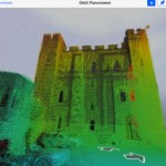
Lokeren, Belgium, March 31st, 2014. Orbit GeoSpatial Technologies releases a great update to the free iOS PanoViewer App, version 10.5 “This update again brings new features to the mobile users”, says Peter Bonne, VP Business Development and Senior Product Manager at Orbit GT. “As the Orbit MM Publisher offers point cloud visualization, the iOS App […]

Filed Under: GIS, Geo Tech Software Tagged With: Geo Tech Software, GIS, News, Orbit GT releases iOS Mobile Mapping viewer 10.5

Trimble Launches New Version of its eCognition Software for Advanced Geospatial Data Analysis

March 29, 2014 By Editor

LOUISVILLE, Ky., March 28, 2014—Trimble (NASDAQ: TRMB) announced today the latest version of its eCognition® software for geospatial data analysis at the American Society for Photogrammetry and Remote Sensing (ASPRS) conference. Trimble eCognition software is a powerful solution for the analysis and extraction of information from geospatial data collected via aerial, satellite and mobile mapping […]

Filed Under: GIS, Geo Tech Software Tagged With: Geo Tech Software, GIS, News, Trimble Launches New Version of its eCognition Software for Advanced Geospatial Data Analysis

New Autodesk 2015 Design Suites Drive Unsurpassed Value for Subscribers

March 27, 2014 By Editor

Expanding Portfolio Combines Tighter Integration with Autodesk 360 Cloud Services & Powerful AutoCAD Enhancements with Convenient, Flexible Subscription Options

Filed Under: GIS, Geo Tech Software Tagged With: Geo Tech Software, GIS, New Autodesk 2015 Design Suites Drive Unsurpassed Value for Subscribers, News

« Previous Page
Next Page »

Recent Industry News

The Drift Between Early Notes and Final Case Files in Abuse-Related Legal Support

April 29, 2026 By GISuser

Aerial Surveys Int’l and Global Marketing Insights to Present GEOINT 2026 Workshop on Multi-Domain Geospatial Fusion for Automated Infrastructure Monitoring

April 24, 2026 By GISuser

Why Timing Matters More Than You Think With Spray Seal (And Why People Often Get It Slightly Wrong)

April 22, 2026 By GISuser

The Quiet Planning Stage Most People Don’t See When Building a Pool in Brisbane

April 22, 2026 By GISuser

Hot News

State of Data Science Report – AI and Open Source at Work

HERE and AWS Collaborate on New HERE AI Mapping Solutions

Virtual Surveyor Adds Productivity Tools to Mid-Level Smart Drone Surveying Software Plan

Categories

Copyright gletham Communications 2015 - 2026

Go to mobile version