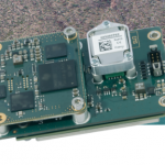
Carrières-sur-Seine, France, April 15th 2019 – SBG Systems will present for the first time at AUVSI’s Xponential show in Chicago (U.S.), the Quanta UAV Series, a brand new line of Inertial Navigation Systems (INS) dedicated to UAV-based Surveying Integrators.
Low-flying Helicopter Survey to Map Subsurface Geology and Groundwater Near Silverton, Colorado

In the public interest, and in accordance with FAA regulations, the USGS is announcing this low-level airborne project.
Market for commercial drones will grow to 38 billion euros
Drones used primarily in energy, construction, agriculture
Event Tip – 2019 UAS Roundup and the Top 5 Reasons to Attend!

This full-day event features discussions about the use of drones to support public safety operations in Colorado.
North America Small UAV Market 2019-2024
North America Small UAV Market 2019-2024: Increasing Applications in Surveying, Aerial Photography, 3D Mapping, & Oil and Gas Pipeline Monitoring
Amsterdam RAI trade fair on commercial use of drones
Amsterdam, 13 March 2019 – From 8 to 10 April, the Amsterdam RAI Exhibition and Convention Centre will host the third edition of the Commercial UAV Expo Europe, the leading European trade fair and conference on the commercial use of drones. The fair is a mecca for professionals in the drone sector who come to […]
Black Swift Technologies Developing Active Navigation Enabling a Fixed-Wing UAS to Fly Autonomously Around Obstacles and Over Rugged Terrain
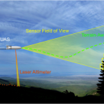
Boulder, CO – (March 18, 2019) – Black Swift Technologies (BST), a specialized engineering firm based in Boulder, CO, announced today it has completed the first phase of a NASA-funded project to demonstrate the effectiveness of fusing a host of onboard sensors to develop a terrain-following fixed-wing unmanned aircraft system (UAS), in this case, it will be demonstrated […]
Pix4D Announces First User Conference in Denver, Colorado @pix4d

Pix4D users are invited to share stories about working with drone mapping
senseFly Introduces eBee X with MicaSense RedEdge-MX
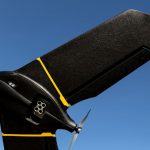
A seamless dual solution for accurate and efficient crop analysis
RDO becomes first WingtraOne drone Certified Repair Center

RDO Integrated Controls and Wingtra to Provide Enhanced Services and Support for the WingtraOne VTOL Survey Drone