Oh man, when will they get it? That’s what I find I’m asking myself once again. Here in the Pacific North West (Victoria BC Canada) we’ve been hit with another snow storm.
Once again that meant that the roads are a mess and in particular, public transit is in turmoil. What I find very interesting is that I’m getting the impression that many people, in particular the local social media junkies, seem to think that Twitter is THE solution for getting the word out about buses, including interruptions in service, delays, etc… I guess Twitter serves as a fine band-aid solution but come on… Twitter as the answer to BC Transit communicating with the public?
I know people will think to themselves, ok, what’s Glenn ranting about now… how about this for a solution – real time information served up on the web and the mobile web! Pretty simple really! Ok, granted, it takes some tech savvy folks, a little $$$ but really, why not? Sorry but Twitter isn’t a viable solution for people standing for an hour at a bus stop wondering where their bus is or when is it coming. Buses are mobile and easily tracked. how about some positioning devices on buses to monitor where they are in real time. Then that information is relayed to a corporate server for display on the website or even better, on a mobile app. People using public transit have smartphones… sure not all of them but many of them do. Just look to any major metropolitan area or Europe and you’ll find fabulous mobile apps for users of public transit.
Users of public transit want to see bus routes and schedules and I’m not talking about static PDFs, those are useless and basically suck! For a person waiting at a bus stop they likely need to know which bus comes to that stop, where is the bus now, when will it be here, and show me where it will go. As I write this, I’m watching a TV reporter give accolades to BC Transit for turning to Twitter to post updates on service. Go ahead an check out what BC Transit did all day long on Twitter – see http://twitter.com/bc_transit. Tweets started at 8 AM, that’s likely when the person charged with the twitter account showed up at work – never mind that the snow had been falling for hours and most people needing bus service to get to work had departed long before this time (oh, take note that all Tweets end at 6PM so if you need info after that you’re out of luck!). Then I guess the person needs to figure out what BC Transit’s twitter address is (it’s @BC_Transit), which hashtags to follow and then they will have to search on the hashtag to retrieve information. Myself, I thought about going out on the bus today and Twitter was no help at all telling me when the #75 bus would be in my area! Indeed, a nice band aid solution but please, save your applause… if I was a daily bus rider I’d be disappointed with the lack of available information from the transit service that serves a population of well over 300,000 people. A tip.. . go Mobile! Develop an application for iPhone and Android mobiles then think about Blackberry as well.
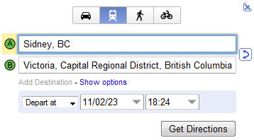
Oh.. FYI, The Victoria BC Transit website was down this morning due to heavy load (I’m guessing). When will they get it?? To the credit of BC Transit, the Victoria public transit bus routes and times are now available to users of Google maps. To use this feature simply use the Google maps “Directions” feature, specify To/from destinations and toggle the blue bus icon… congrats for getting this information online (I suspect this may have been the result of a recent Geo hack day). I suggest any metro bus service do this as a starting point, hopefully soon after a savvy developer will come out with a cool mobile app for riders. See also this previous post: Google Transit Program and Mobile Transit apps – A Starting Point for public transit
See also this resource on Google
For some fine examples of mobile, public transit apps see also the following on Google or in the Apple iTunes store: TransLoc, PDX Transit app, NYC Transit