GIS user technology news

News, Business, AI, Technology, IOS, Android, Google, Mobile, GIS, Crypto Currency, Economics

  • Advertising & Sponsored Posts
    • Advertising & Sponsored Posts
    • Submit Press
  • PRESS
    • Submit PR
    • Top Press
    • Business
    • Software
    • Hardware
    • UAV News
    • Mobile Technology
  • FEATURES
    • Around the Web
    • Social Media Features
    • EXPERTS & Guests
    • Tips
    • Infographics
  • Blog
  • Events
  • Shop
  • Tradepubs
  • CAREERS
You are here: Home / * PRESS / Hardware / Multi-Display Signage for the Federal Sector

Multi-Display Signage for the Federal Sector

November 17, 2022 By GISuser

Matrox and BrightSign are ready for deployment

Multi-Display Signage for the Federal Sector

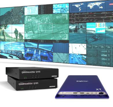
BrightSign and Matrox join forces in this webinar that unpacks your biggest questions on selecting the right digital signage solution for the government, military and defense sectors for when security is of utmost importance.

Watch now to learn more!

Offered Free by: Matrox Video
See All Resources from: Matrox Video

Filed Under: Featured TOP PR, Hardware Tagged With: display, Matrox

Editor’s Picks

Brothers Code is fueling the diverse tech talent pipeline by teaching 250+ young men of color code

20th INTERGEO opens in Berlin!

Esri Helps Developers Add Geo to Apps at TechCrunch Disrupt NY 2016

Now Available: Explorer for ArcGIS on Android #mobiletip

See More Editor's Picks...

Recent Industry News

Why Bathroom Renovation Services Often Change More Than Just the Bathroom

May 20, 2026 By GISuser

The Drift Between Early Notes and Final Case Files in Abuse-Related Legal Support

April 29, 2026 By GISuser

Aerial Surveys Int’l and Global Marketing Insights to Present GEOINT 2026 Workshop on Multi-Domain Geospatial Fusion for Automated Infrastructure Monitoring

April 24, 2026 By GISuser

Why Timing Matters More Than You Think With Spray Seal (And Why People Often Get It Slightly Wrong)

April 22, 2026 By GISuser

Hot News

State of Data Science Report – AI and Open Source at Work

HERE and AWS Collaborate on New HERE AI Mapping Solutions

Virtual Surveyor Adds Productivity Tools to Mid-Level Smart Drone Surveying Software Plan

Categories

Copyright gletham Communications 2015 - 2026

Go to mobile version