Vaughan, Ontario, CANADA – February 3, 2022 – Teledyne Geospatial announced the sale of its next generation bathymetric lidar CZMIL SuperNova to leading professional services firm Dewberry. Dewberry is the first private North American company to purchase the CZMIL SuperNova, adding this unique capability in support of state and federal coastal zone mapping programs, surveying of wetlands, lacustrine and riverine systems, submerged habitat detection and offshore mapping for renewable energy governance.
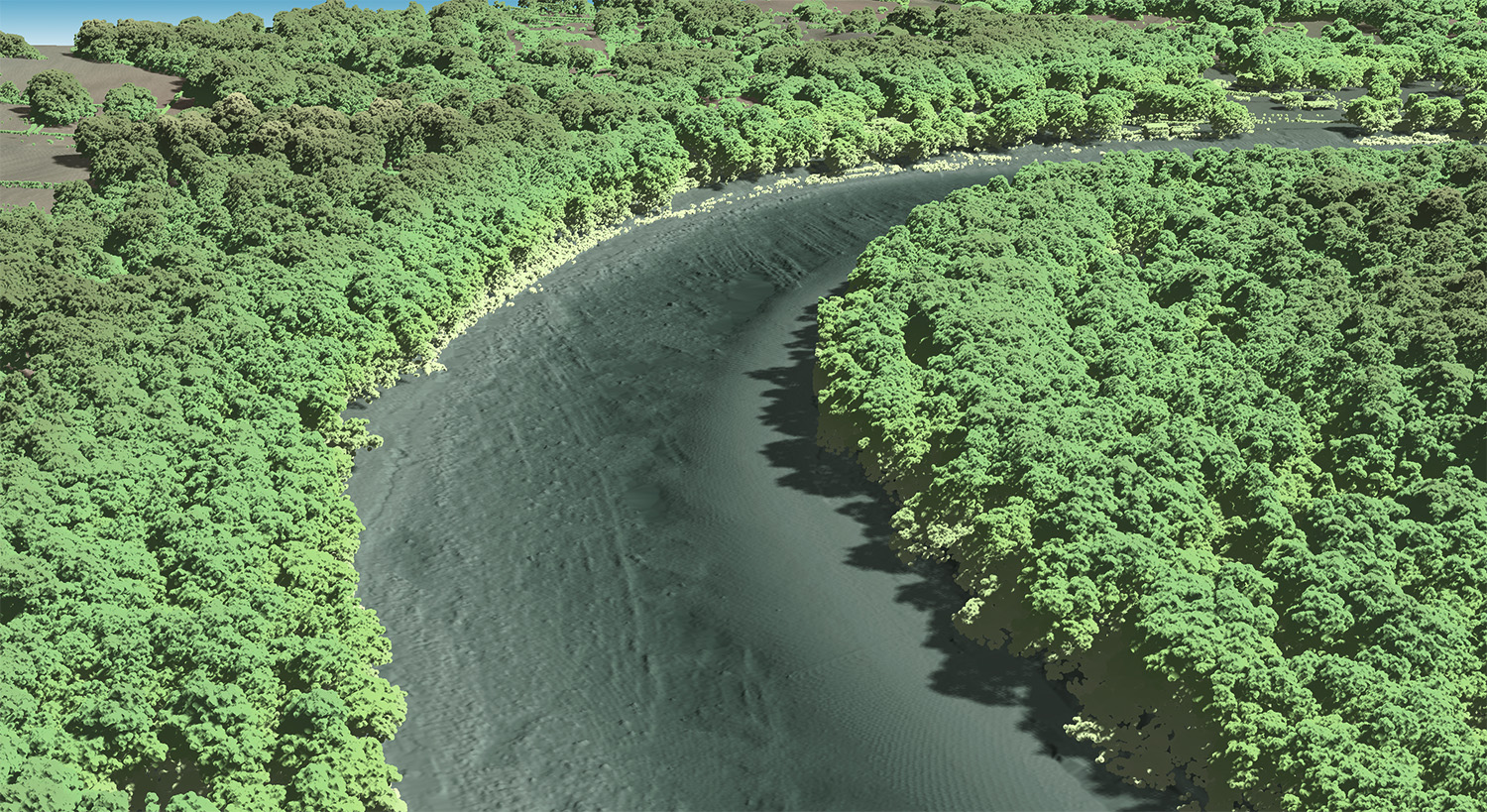
A recent CZMIL SuperNova topobathy collect over the Potomac River in Maryland
Photo credit: Image coutesy of Dewberry
The CZMIL SuperNova’s ability to deliver Quality Level 1 (QL1) data from altitudes greater than 1,200 feet and its Secchi depth penetration range (down to 70 meters in optimal conditions) will allow Dewberry to deliver the quality data required for their projects. Leveraging advanced artificial intelligence and machine learning (AI/ML) techniques for automated land/water discrimination and noise classification, the CZMIL SuperNova bathymetric solution also sets a new standard in processing workflow efficiency through automation in the CARIS software suite without compromising quality.
Dewberry Senior Vice President Amar Nayegandhi states, “In 2022 Dewberry will provide clients with unmatched capabilities in coastal, wetland and inland riverine mapping. This investment in the CZMIL SuperNova and collaboration with Teledyne Geospatial solidifies Dewberry’s commitment to client excellence through the acquisition and delivery of the highest quality topo-bathy capability available in the market. The impressive Secchi depth and single-source workflow features will enhance the speed and accuracy of deliverables to our clients.”
Teledyne Geospatial North America Senior Sales Manager Brenda Burroughs comments, “We are thrilled that Dewberry will be the first privately owned North American company to take possession of the CZMIL SuperNova and are excited to continue our collaboration as they add this exceptional capability to their portfolio. The CZMIL SuperNova will empower Dewberry with a geospatial solution for acquiring, processing, and delivering data projects within a single workflow underpinned by a CARIS software toolkit that will automate data classification and expedite the delivery of projects with the net benefit going to their customers.”
Teledyne Geospatial unifies the hardware and software expertise of both Teledyne CARIS and Teledyne Optech. The new group provides customers with innovative integrated solutions. Offerings include turnkey systems, lidar and sonar integrated workflows and a range of systems and solutions that support holistic, precision data collection.
Dewberry is a leading, market-facing firm with a proven history of providing professional services to a wide variety of public- and private-sector clients. Recognized for combining unsurpassed commitment to client service with deep subject matter expertise, Dewberry is dedicated to solving clients’ most complex challenges and transforming their communities. Established in 1956, Dewberry is headquartered in Fairfax, Virginia, with more than 50 locations and 2,000+ professionals nationwide. To learn more, visit www.dewberry.com.