In early 2020 the OceanWise team was putting the final touches to an environmental monitoring system which was destined for Africa. Despite mounting restrictions imposed amid the global Covid-19 pandemic, the team innovated using remote working to ensure delivery and installation of the all-important system, whilst maintaining high standards throughout.
The Aim
To improve monitoring of environmental conditions at a terminal and mooring buoy.
Data Requirement Operational safety and planning, and as input to potential development studies. The data must be reliable, accurate and accessible to operational personnel locally, other personnel nearby (including offshore) and to other offices around the world.
Parameters Required:
- Wind
- Weather
- Tide
- Surge and water levels
- Currents
- Wave height, period and direction
Sensors and System
The system was designed by OceanWise specifically to meet the customer’s unique requirements.
It included in situ sensors from Valeport and Gill Instruments, the OceanWise modem (ip.buffer), and Port-Log (our online data collection, management and dissemination system).
The challenge
By March 2020, the sensors had been delivered to OceanWise, the system was built and we were ready to undertake a final configuration regarding cable run lengths and undertake a Factory Acceptance Test (FAT). The site survey, which usually requires at least one member of the OceanWise team to attend site, was now not possible due to Covid-19 restrictions in the UK and around the world.
Rather than cancel this important part of the project, we quickly realised that we were well set up already to work from home … could we do this work remotely?
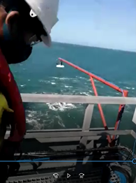
A plan of work was prepared, including safety considerations, and the key outcomes that would have been the responsibility of the OceanWise engineer, had he (or she) been on site, were relayed to the customer’s operational personnel. Telecommunications between Africa and Hampshire were tested including video, which was essential to record all the usual aspects of a site visit. After a series of online meetings we were able to record the information required and direct onsite personnel accordingly – ultimately allowing us to complete a Site Survey Report in the normal way without leaving home!
By mid-April, the final configuration, system build and tests had been completed and the system had been packaged up and was ready to ship overseas but what about the actual installation?
With the UK still in lockdown, our engineer was unable to travel. Although the site survey had been completed almost perfectly, undertaking a successful installation remotely as well would be quite a challenge.
After much consideration, planning and liaison with all teams this is exactly what we were able to do, again directing our customer’s onsite personnel accordingly. Following the process as for the site survey, a series of short online meetings were planned, each to accomplish specific tasks.
We then went through what would be required to install the enclosure, radar, weather station and ultimately instruct divers to put in place the underwater fixings and sensors.
This took several days during which time we were able to connect to the ip.buffer (our smart telemetry modem) remotely to test and reconfigure the system, such as being able to switch sensors to factory mode for a period to check that the quality of data was as expected.
What have we learnt?
Firstly, along with office based remote working, site survey, installation work and acceptance tests can be accomplished remotely if accompanied by extensive and detailed planning.
As a team whilst we have been challenged by the recent pandemic, we have also grown and developed and have enjoyed exploring new ways of working.
The commitment of the team, the customer, and the expertise, cooperation and sometimes patience of onsite personnel was essential.