GIS user technology news

News, Business, AI, Technology, IOS, Android, Google, Mobile, GIS, Crypto Currency, Economics

  • Advertising & Sponsored Posts
    • Advertising & Sponsored Posts
    • Submit Press
  • PRESS
    • Submit PR
    • Top Press
    • Business
    • Software
    • Hardware
    • UAV News
    • Mobile Technology
  • FEATURES
    • Around the Web
    • Social Media Features
    • EXPERTS & Guests
    • Tips
    • Infographics
  • Blog
  • Events
  • Shop
  • Tradepubs
  • CAREERS
You are here: Home / * PRESS / DATA / Ordnance Survey and partners to create pilot map of the North East that could eventually lead to a national register of underground assets

Ordnance Survey and partners to create pilot map of the North East that could eventually lead to a national register of underground assets

April 29, 2019 By GISuser

A digital map of underground pipes and cables is to be created, to help save lives and reduce the disruption caused when they are struck by mistake.
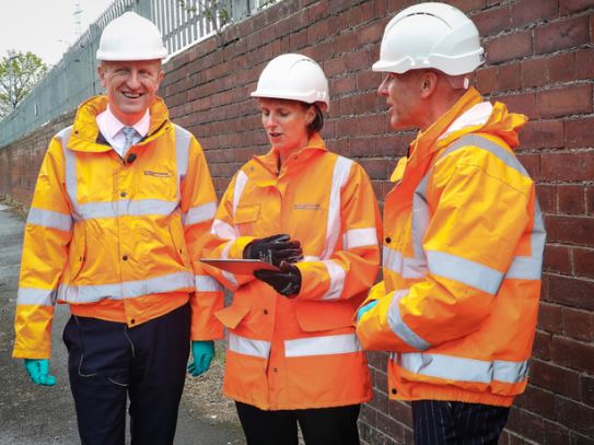
 A digital map of underground pipes and cables is to be created


A digital map of underground pipes and cables is to be created

It is estimated that the cost of accidental strikes on underground pipes and cables is £1.2 billion a year to the UK’s economy. Workers who hit gas and electric pipes by mistake can also put themselves in danger of death or serious injury.

To help prevent such accidents, the government’s Geospatial Commission has announced its ambition to bring together the existing data on underground pipes and cables to create an Underground Assets Register. This has begun with pilot projects in London and the North East, to test the feasibility of the project.

Minister for Implementation, Oliver Dowden, visited Sunderland to see the work which is already underway to map the area’s underground network. He said: “When workers strike pipes and cables, it risks lives, costs money and causes havoc for residents and road-users.

Our investment in this cutting-edge underground map is just one way that the government is working smarter, so that we really make a difference to people’s everyday lives.”

There is currently no comprehensive underground map of the UK’s service network.

Different organisations have their own maps showing where such things as gas pipes and electricity cables are, but the lack of a combined map creates an increased risk of potentially lethal accidents.

Work to tackle the problem has so far seen working prototypes created in Sunderland and London. This allows workers to see underground pipes and cables on mobile phones or laptop computers before they start a dig.

In the North East, the project has been led by Ordnance Survey, who have worked with Northumbrian Water, Northern Gas Networks, Northern Powergrid, and Openreach. In London, work going forward will be led by the Greater London Authority, who are working closely with infrastructure providers and local authorities.

David Henderson, the managing director of Ordnance Survey Great Britain, said: “The creation of an underground map of utility assets has long been an ambition of Ordnance Survey. And over the last year we have been working closely with Northumbrian Water and a consortia of utility companies and local authorities in the North East of England, to explore how accurate geospatial data can improve underground infrastructure maintenance and inform new-build development projects.

“The investment being made by the Geospatial Commission will ultimately enable the utility industry to more efficiently access, use and share data describing otherwise hidden infrastructure, thereby reducing operational costs, minimising disruption and accelerating completion of site works.”

Heidi Mottram CBE, CEO of Northumbrian Water, who hosted the visit said: “We are delighted to host the Minister for Implementation today to demonstrate the progress we have made since our Innovation Festival last year, when we first started exploring this idea.

Working alongside local authorities, other utility services and partners has meant that we are off to a good start in mapping Sunderland’s underground. We are looking forward to working with government and others to showcase the powers of data sharing for public good.

Filed Under: DATA, UTILITIES

Top Press

The Global Expansion of Aueshah: A New Era of High Jewelry

April 11, 2026 By GISuser

KARACHI, PAKISTAN. The international luxury market is experiencing a profound shift. Consumers are increasingly rejecting mass-produced goods in favor of rarity, authenticity, and emotional depth. … [Read More...]

State of Data Science Report – AI and Open Source at Work

September 10, 2025 By GISuser

AI and Open Source at Work … [Read More...]

Topcon Announces Landmark Expansion of Topnet Live Network Across USA

January 26, 2025 By GISuser

LIVERMORE, Calif.---Topcon Positioning Systems has announced a significant expansion of its Topnet Live reference station network, introducing 200 new geodetic stations strategically positioned across … [Read More...]

Space Flight Laboratory (SFL) Announces Launch and Deployment of NorSat-4 Maritime Monitoring Microsatellite

January 19, 2025 By GISuser

Seventh Satellite Developed by SFL for Norway … [Read More...]

HERE and BMW Group extend partnership on AI-powered mapping system

January 8, 2025 By GISuser

HERE and BMW Group extend partnership on AI-powered mapping system for automated driving and enhanced road safety … [Read More...]

SFL Missions Inc. Confirms Successful Deployment of Six HawkEye 360 Radio Frequency Detection Satellites with Advanced Capabilities

October 27, 2026 By GISuser

MĀHIA, New Zealand, 26 October 2026 – SFL Missions Inc. today confirmed the successful deployment of six radio frequency (RF) detection and geolocation satellites for HawkEye 360 … [Read More...]

Canadian-Built RoadEng 12 Uses AI to Find the Best Location for New Resource and Rural Roads

October 17, 2026 By GISuser

Vancouver, BC, Canada, October 15, 2026 – North Vancouver-based Softree Technical Systems today released RoadEng Version 12, used in more than 75 countries to locate and design … [Read More...]

Beyond the Map: How AI Image and Video Generation Is Changing Geospatial Communication

October 14, 2026 By GISuser

Ask anyone who has shipped a GIS project what the hardest part was, and the answer is rarely the spatial analysis. It is almost always the communication. A site suitability … [Read More...]

From Maternity to Everyday Wear: Building a Wardrobe That Grows With You

October 14, 2026 By GISuser

When I think about maternity clothing, I feel the biggest mistake is buying too many things at once. During pregnancy, your body keeps changing, and something that fits well today … [Read More...]

eMMC 5.1 Explained: Features, Performance, and Applications in Modern Devices

October 14, 2026 By GISuser

Storage technology is an essential part of modern computing, influencing how devices store information, launch applications, and manage everyday workloads. Although … [Read More...]

Copyright gletham Communications 2015 - 2026

Go to mobile version