GIS user technology news

News, Business, AI, Technology, IOS, Android, Google, Mobile, GIS, Crypto Currency, Economics

  • Advertising & Sponsored Posts
    • Advertising & Sponsored Posts
    • Submit Press
  • PRESS
    • Submit PR
    • Top Press
    • Business
    • Software
    • Hardware
    • UAV News
    • Mobile Technology
  • FEATURES
    • Around the Web
    • Social Media Features
    • EXPERTS & Guests
    • Tips
    • Infographics
  • Blog
  • Events
  • Shop
  • Tradepubs
  • CAREERS
You are here: Home / * PRESS / Software / The Secret Weapon to Boost Surveying Productivity–SuperSurv

The Secret Weapon to Boost Surveying Productivity–SuperSurv

June 10, 2016 By GISuser

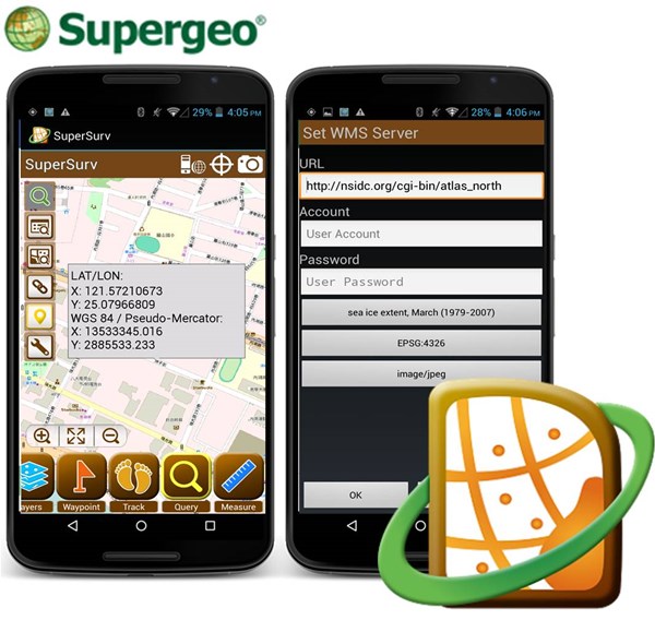
Supergeo has recently released the newest updated version of the mobile GIS software –SuperSurv 3.3. In this version, we further improved the manipulation of WMS layers, which now users can more flexibly add them as references and basemaps.

And we also adjusted the layout of OGC setting page to make it more intuitive. More important, the waypoints can be exported as GEO and SHP formats, so they can overlay to existing project files directly or can be applied to spatial analysis and map displaying. Except these new features, recently we are also keen to support diverse high precision surveying devices, which would significantly enhance the accuracy of field surveying.

Specially designed for field workers to collect spatial data, SuperSurv is mobile GIS software available on two major operating systems of mobile devices: iOS and Android. By integrating GIS and GPS technologies, it provides various capabilities for the users, including spatial data creation, querying, and measurement. Furthermore, SuperSurv supports both online and offline basemap settings to adapt different surveying environments. Also, SuperSurv works well with other SuperGIS products, such as SuperGIS Desktop for data editing and SuperGIS Server for data sharing. Finally, its user-friendly interface and easy-to-use workflow allow every SuperSurv users to collect spatial data and accomplish field tasks with ease.

Supergeo provides the trial of SuperSurv on App Store and Google Play. So why don’t you download and experience its powerful GIS and surveying capabilities for free?


Learn more information about SuperSurv:
http://www.supergeotek.com/ProductPage_SuperSurv.aspx

Or contact us directly by:
staff@supergeo.com.tw
Filed Under: Software Tagged With: SuperGeo, SuperSurv

Editor’s Picks

GIS and History: Using the Past to Inform the Present

Data Tip – Customized Coverage from LandScan Global Population Database

Call For Papers – Location Based Services 2015 Innovate with Location Data

50 startups from 17 countries to showcase their innovative Internet of Things approaches at CeBIT

See More Editor's Picks...

Recent Industry News

Increase Rev vs. Google AdSense: Unlocking 50%–200% Higher Earnings

August 17, 2026 By GISuser

From Simulator to Open Air: A Practical Start to FPV Flying Safely

August 14, 2026 By GISuser

Pop-Up Card Wallets vs Traditional Slim Wallets: Which Is Better?

August 11, 2026 By GISuser

Comment les PME et commerçants du Québec optimisent la livraison du dernier kilomètre pour fidéliser leurs clients

August 8, 2026 By GISuser

Hot News

State of Data Science Report – AI and Open Source at Work

HERE and AWS Collaborate on New HERE AI Mapping Solutions

Virtual Surveyor Adds Productivity Tools to Mid-Level Smart Drone Surveying Software Plan

Categories

Copyright gletham Communications 2015 - 2026

Go to mobile version