GIS user technology news

News, Business, AI, Technology, IOS, Android, Google, Mobile, GIS, Crypto Currency, Economics

  • Advertising & Sponsored Posts
    • Advertising & Sponsored Posts
    • Submit Press
  • PRESS
    • Submit PR
    • Top Press
    • Business
    • Software
    • Hardware
    • UAV News
    • Mobile Technology
  • FEATURES
    • Around the Web
    • Social Media Features
    • EXPERTS & Guests
    • Tips
    • Infographics
  • Blog
  • Events
  • Shop
  • Tradepubs
  • CAREERS
You are here: Home / * PRESS / LiDAR / UC Notes – GeoExpress 9.5 Now Supports Native Compression of LiDAR

UC Notes – GeoExpress 9.5 Now Supports Native Compression of LiDAR

August 11, 2015 By GISuser

Lizardtech has continued with their tradition of annual software releases with the announced release of GeoExpress 9.5. The product was announced at esriuc and justifiably so, particularly given the attention that has been paid to LiDAR and the use of imagery at this year’s UC.
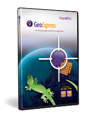
GeoExpress 9.5 Now Supports Native Compression of LiDAR

At release 9.5 LiDAR compress is now built into MrSID, and this comes at no extra cost to the user. LiDAR is supported by the MrSID MG4 data format and support is also provided for LAS and txt and output to LAS is also provided. GeoExpress enables the user to to compress raster imagery to the much compressed MrSID and JPEG 2000 data formats, additionally, LiDAR data conversion to MrSID and LAZ formats is now provided.

Other notable benefits of using GeoExpress 9.5 include:

  • Reduction in storage costs provided by crunching data to less than 5% or original size
  • More visually appealing data
  • Compression I of LiDAR point clouds
  • Creation of seamless mosaics
  • Imagery color balancing
  • Cropping and export
  • Imagery re projection
  • Flexible licensing that supports sharing of tools throughout your organization
See more info at Lizardtech.com/products/GeoExpress
See also Download GeoViewer 9 today.
Note, LizardTech will be hosting a live webinar on August 13 – The webinar will be hosted by LizardTech expert and sales engineer Robert Parker who will highlight the new benefits of GeoExpress® 9.5.  To register for the webinar see  HERE.

Filed Under: LiDAR, Software, Top Press Tagged With: GeoExpress, LiDAR, LizardTech

Editor’s Picks

Is Sustainable Tourism Sustainable? Mapping Outcomes Using GIS

Event Review, Commercial Drone Expo

Web GIS Gets A Huge Boost From Esri – What’s New in ArcGIS 10.3

Introducing the new, HP Z Series Workstation Portfolio – Event recap, images, video and key numbers

See More Editor's Picks...

Recent Industry News

Patients Report Infections Linked to Reusable Medical Devices

July 27, 2026 By GISuser

Bird Netting Installation in Dubai for Property Care 

July 11, 2026 By GISuser

How AI Helps Identify Crystals From Photos

July 10, 2026 By GISuser

The Future of Competitive Gaming: Why DMA Technology is the Ultimate Performance Edge

June 24, 2026 By GISuser

Hot News

State of Data Science Report – AI and Open Source at Work

HERE and AWS Collaborate on New HERE AI Mapping Solutions

Virtual Surveyor Adds Productivity Tools to Mid-Level Smart Drone Surveying Software Plan

Categories

Copyright gletham Communications 2015 - 2026

Go to mobile version