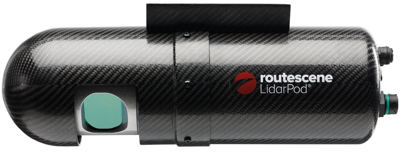
The Routescene® proposition to transform the approach to surveys across the world is taking hold. Identifying massive potential and a gap in the market, Routescene® developed the LidarPod®, market-leading 3D mapping technology designed specifically for use on Unmanned Aerial Vehicles (UAVs). Launched at Intergeo 2014 in Berlin, the highly acclaimed LidarPod® has attracted interest and is generating business across four continents.
Our aim is to radically alter the surveying world, allowing surveys to take place that previously would have been cost or time prohibitive. The Routescene LidarPod was developed to save time, improve efficiencies and productivity. The LidarPod enables faster surveys, decreasing time in the field and reducing data download time, ensuring users are working with resulting datasets within hours. These business benefits, readily understood and well received by customers, means surveying is more accessible, can be applied to more scenarios and enables customers to allocate budget more effectively.
The LidarPod has many applications from utilities including powerline inspection, forestry such as biomass volumes to cut and fill analysis in mining, as well as highway mapping and surveys. Uses are many and varied as the LidarPod is a turnkey system which is lightweight, compact and quick to deploy in the field. It can be used on vehicles as well as UAVs, so is flexible in many different environments.
In the first ten months since launch the team at Routescene have worked tirelessly to create awareness for this ground-breaking product, attending trade shows, exhibitions, providing demonstrations and undertaking pilots in Australia, Asia, Europe and North America. To ensure the business is accessible globally and to provide timely customer service, the company has appointed Imagemaps as a distributor in Australia and SE Asia, opened an office in Scandinavia, with further distributors to be announced over the coming months. ENDS
ww.routescene.com