The Collector app is being called a game changer by Oklahoma Forestry Services (OFS) as it becomes the first state agency in the nation to utilize it for wildfire initial attack. This new, cutting-edge app enhances fire situational awareness by pulling all of the information and tools needed to fight wildfires into one program. Collector, developed by Esri, a company which specializes in information management, provides critical information quickly, resulting in faster fire suppression, and increased safety for the public and firefighters.
Wildfire: There’s an App for That
“There have been other products out there that gave us some information, but none that provided nearly instantaneous, real-time transfer of information until Collector,” said Mark Goeller, fire management chief, Oklahoma Forestry Services. ”It means that fires can be more quickly sized up and firefighters efficiently deployed to the areas where they are most needed.”
Arriving on the scene of a large wildfire incident, firefighters must quickly assess the situation, devise a strategy and develop tactics to convey to the other responders. Collector facilitates the process, allowing for accurate and timely analysis including fire perimeter, vital incident information and incident progress for all responders to receive real-time on their mobile devices.
In addition to seeing the fire size and location on their devices, the firefighters can also:
· View structures, roads and terrain
· Measure land by distance and area, including affected acreage
· Type in an address or GPS location and get directions and maps
· Attach, view and edit photos and documents
· Download maps and work offline
· Track and report incident progress
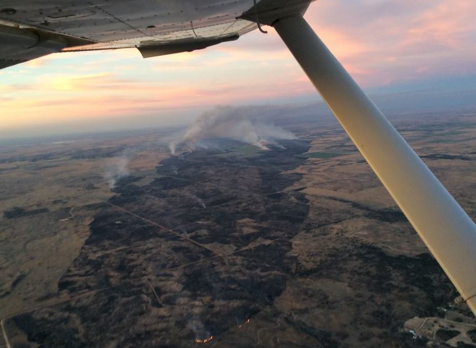
“The Guthrie fire in May 2014 provides a good example of how utilizing the Collector app saved time and prevented the loss of additional homes and structures,” said Goeller. “We utilized the app in an Oklahoma Highway Patrol aircraft and communicated fire behavior and difficult access to ground crews, enabling them to halt the fire spread well before reaching additional structures.
Before Collector, this type of aerial intelligence was conveyed through radio communication, visually directing crews to specific areas using landmarks that could be seen from the aircraft.”
The OFS observer in the aircraft used Collector on an iPad to draw a needed fire line on the map, which was communicated in near real time on the iPad map held by ground personnel. The ground firefighters were able to quickly see their location and where they need to go. By utilizing the Collector app, it is estimated that in this instance firefighters began firefighting at least an hour sooner than without the technology.
Oklahoma Forestry Services is the state’s lead agency for fighting wildland fire. The agency has successfully utilized the Collector app on numerous wildland fires in the past year, introducing the app to firefighters, Oklahoma Highway Patrol pilots and other fire professionals in the process. It is in the initial stages of rolling it out to county wildland task forces and fire departments across the state.
About Oklahoma Forestry Services
Oklahoma Forestry Services, a division of the Oklahoma Department of Agriculture, Food and Forestry, is committed to conserving, enhancing and protecting Oklahoma’s 12.5 million acres of forests and woodlands. Since 1925, Oklahoma Forestry Services has worked with individuals and communities throughout the state to create resilient landscapes, fire-adaptive communities and provide wildfire response. Headquartered in Oklahoma City, the division also has regional offices in Goldsby, Broken Bow, Wilburton and Tahlequah. For more information, visit http://www.forestry.ok.gov.
[Tweet “Wildfire: There’s an App for That”]