GIS user technology news

News, Business, AI, Technology, IOS, Android, Google, Mobile, GIS, Crypto Currency, Economics

  • Advertising & Sponsored Posts
    • Advertising & Sponsored Posts
    • Submit Press
  • PRESS
    • Submit PR
    • Top Press
    • Business
    • Software
    • Hardware
    • UAV News
    • Mobile Technology
  • FEATURES
    • Around the Web
    • Social Media Features
    • EXPERTS & Guests
    • Tips
    • Infographics
  • Blog
  • Events
  • Shop
  • Tradepubs
  • CAREERS
You are here: Home / * PRESS / Business / OGC Information Technology Standards for Sustainable Development white paper announced

OGC Information Technology Standards for Sustainable Development white paper announced

March 9, 2015 By GISuser

9 March 2015. The Open Geospatial Consortium (OGC®) membership has approved the OGC® Information Technology Standards for Sustainable Development white paper. This important document for environmental science, business and policy is available free at https://portal.opengeospatial.org/files/60920.

An integrated information technology (IT) standards platform for communicating digital environmental data is a critical requirement for social and economic progress in the “Anthropocene Epoch”, the current era in which humanity’s expanding footprint has become the main cause of change in the planet’s geology, water bodies, atmosphere and biosphere. The authors argue for a concerted and ongoing global effort to 1) define data communication and system interoperability requirements for environmental science, business and policy, and then 2) develop and implement consensus-derived, free and open environmental Information Technology (IT) standards that meet those requirements and that co-evolve with the larger IT standards framework and advances in IT.
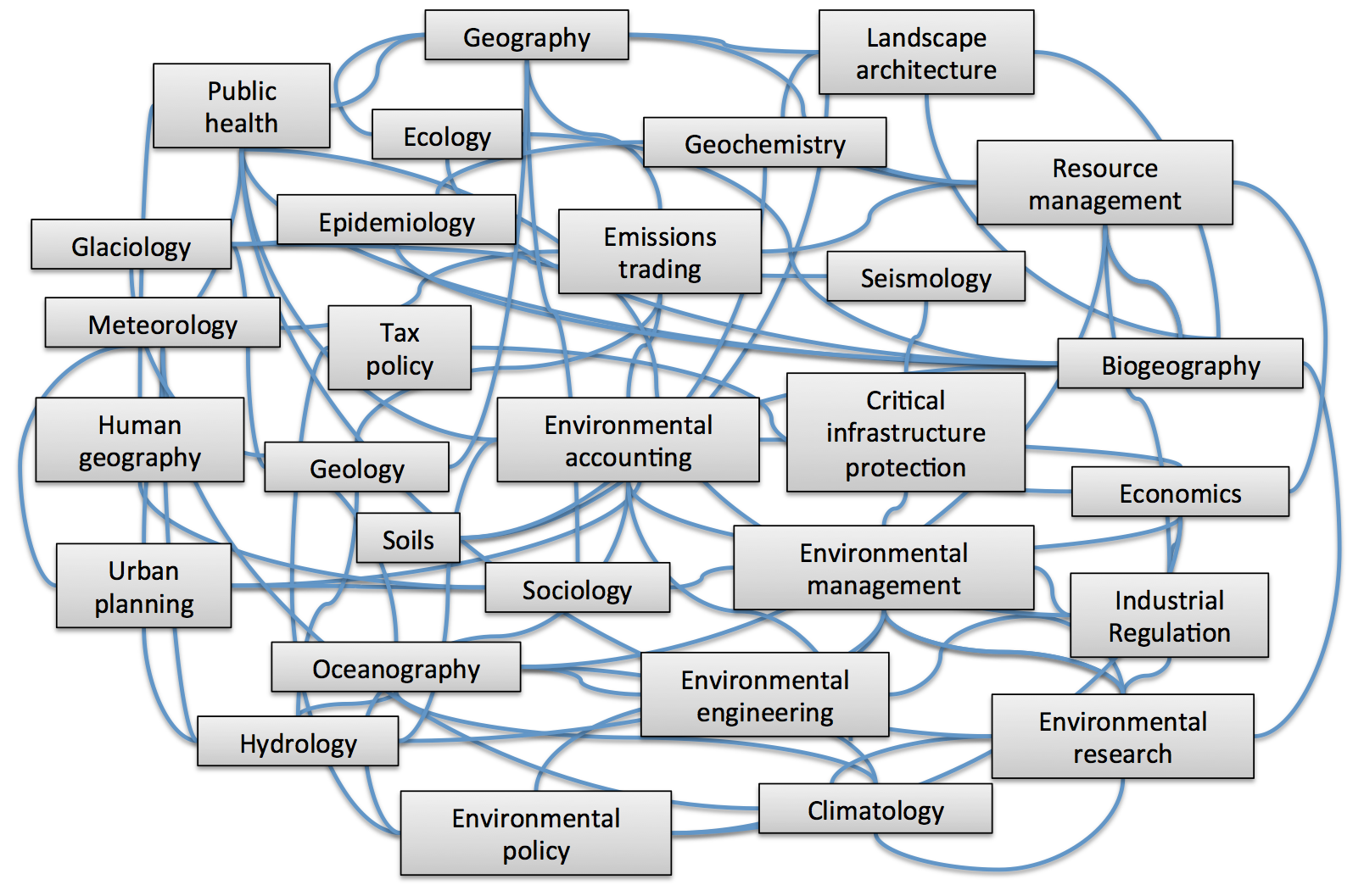
Measuring and managing our impact on the Earth requires constant and widespread communication and integration of spatial environmental information.
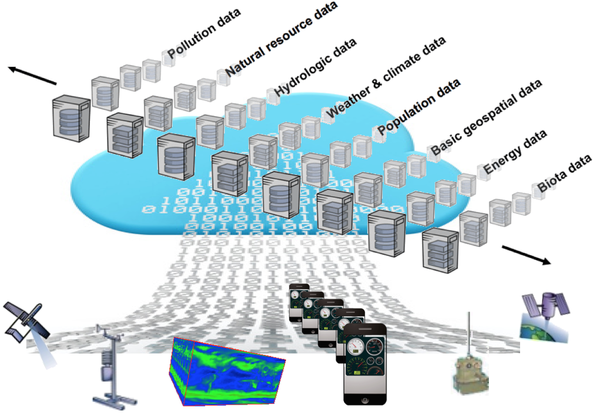
The volume of environmental data flowing from sensors, satellites, citizens, models etc. grows exponentially. However, it has little value if it can’t be easily discovered, assessed, accessed, compared, aggregated, processed, and passed from system to system.

Denise McKenzie, OGC’s Executive Director, Communications and Outreach, will be presenting on the whitepaper on Thursday, 12 March, as the key speaker in the Sustainable Management of our Natural Resources stream at the Locate15 conference in Brisbane, Australia.

The OGC® is an international consortium of more than 500 companies, government agencies, research organizations, and universities participating in a consensus process to develop publicly available geospatial standards. OGC standards support interoperable solutions that “geo-enable” the Web, wireless and location-based services, and mainstream IT. Visit the OGC website at http://www.opengeospatial.org/.

Filed Under: Business Tagged With: announced, Business, development, for, information, OGC, paper, standards, sustainable, Technology, white

Top Press

The Global Expansion of Aueshah: A New Era of High Jewelry

April 11, 2026 By GISuser

KARACHI, PAKISTAN. The international luxury market is experiencing a profound shift. Consumers are increasingly rejecting mass-produced goods in favor of rarity, authenticity, and emotional depth. … [Read More...]

State of Data Science Report – AI and Open Source at Work

September 10, 2025 By GISuser

AI and Open Source at Work … [Read More...]

Topcon Announces Landmark Expansion of Topnet Live Network Across USA

January 26, 2025 By GISuser

LIVERMORE, Calif.---Topcon Positioning Systems has announced a significant expansion of its Topnet Live reference station network, introducing 200 new geodetic stations strategically positioned across … [Read More...]

Space Flight Laboratory (SFL) Announces Launch and Deployment of NorSat-4 Maritime Monitoring Microsatellite

January 19, 2025 By GISuser

Seventh Satellite Developed by SFL for Norway … [Read More...]

HERE and BMW Group extend partnership on AI-powered mapping system

January 8, 2025 By GISuser

HERE and BMW Group extend partnership on AI-powered mapping system for automated driving and enhanced road safety … [Read More...]

Canadian-Built RoadEng 12 Uses AI to Find the Best Location for New Resource and Rural Roads

October 17, 2026 By GISuser

Vancouver, BC, Canada, October 15, 2026 – North Vancouver-based Softree Technical Systems today released RoadEng Version 12, used in more than 75 countries to locate and design … [Read More...]

Beyond the Map: How AI Image and Video Generation Is Changing Geospatial Communication

October 14, 2026 By GISuser

Ask anyone who has shipped a GIS project what the hardest part was, and the answer is rarely the spatial analysis. It is almost always the communication. A site suitability … [Read More...]

From Maternity to Everyday Wear: Building a Wardrobe That Grows With You

October 14, 2026 By GISuser

When I think about maternity clothing, I feel the biggest mistake is buying too many things at once. During pregnancy, your body keeps changing, and something that fits well today … [Read More...]

eMMC 5.1 Explained: Features, Performance, and Applications in Modern Devices

October 14, 2026 By GISuser

Storage technology is an essential part of modern computing, influencing how devices store information, launch applications, and manage everyday workloads. Although … [Read More...]

SFL Missions Inc. Confirms Successful Deployment of Two GHGSat Greenhouse Gas Monitoring Microsatellites

October 3, 2026 By GISuser

TORONTO, Ontario, Canada, 2 October 2026 – SFL Missions Inc. confirms the successful launch and deployment of the GHGSat-C18 (Eleanor) and GHGSat-C19 (Aidan) commercial greenhouse … [Read More...]

Copyright gletham Communications 2015 - 2026

Go to mobile version