GIS user technology news

News, Business, AI, Technology, IOS, Android, Google, Mobile, GIS, Crypto Currency, Economics

  • Advertising & Sponsored Posts
    • Advertising & Sponsored Posts
    • Submit Press
  • PRESS
    • Submit PR
    • Top Press
    • Business
    • Software
    • Hardware
    • UAV News
    • Mobile Technology
  • FEATURES
    • Around the Web
    • Social Media Features
    • EXPERTS & Guests
    • Tips
    • Infographics
  • Blog
  • Events
  • Shop
  • Tradepubs
  • CAREERS
You are here: Home / * PRESS / Maps and Cartography / High Accuracy GIS Total Solution by FOIF SuperGIS

High Accuracy GIS Total Solution by FOIF SuperGIS

December 23, 2014 By GISuser

Supergeo Technologies, the global leading GIS software and solution provider, announced the cooperation with Suzhou FOIF Co. (FOIF) in providing worldwide surveyors with high accuracy GIS turnkey solution.

Mobile GIS is the base to establish GIS infrastructure with field data. And, data accuracy determines the quality and following processing time and cost. However, traditional survey instruments or post-processing usually cost a lot.

Having more than 50-year experience in geo-related surveying equipment manufacturing, FOIF presents gyroscope station, total stations, theodolites, laser products, GNSS and so on. By collaborating with FOIF, a reputed and professional hardware provider, Supergeo is able to provide users around the world with a complete GIS solution:

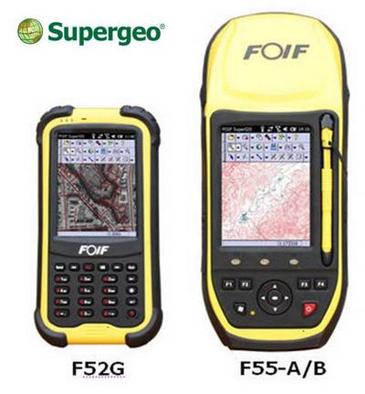
■ Field Controller: F52 and F55 Series Handheld devices

■ Field Software: FOIF SuperGIS (with complete mobile GIS functions, plus NTRIP real time correction solution)

■ Office Software: FOIF SuperGIS-Desk

FOIF company is offering a special offer for worldwide GIS users. For more information about FOIF SuperGIS, please contact Shirley Kong (shirley_kong@foif.com.cn) or refer tohttp://www.foif.com/news/gis-solutions for more details.

SuperGIS Desktop free trial
http://www.supergeotek.com/download_6_desktop.aspx

Filed Under: Maps and Cartography Tagged With: GNSS, surveying

Editor’s Picks

10 Question GeoGeek Rapidfire – Ted Florence @Avenza

First Look – Los Angeles Opens the GeoHub – #OpenData for Citizens and Developers

DigitalGlobe Satellite Captures Dramatic Images of Alberta, Canada Oil Sands wildfire #fmmfire

NOAA’s Lake Level Viewer of the Great Lakes

See More Editor's Picks...

Recent Industry News

The Future of Competitive Gaming: Why DMA Technology is the Ultimate Performance Edge

June 24, 2026 By GISuser

Milwaukee M18FHZ-0 Hackzall Reciprocating Saw – For hardcore cutting in a compact size

June 19, 2026 By GISuser

How Enterprises Are Using AI to Automate 80% of Customer Interactions With Voice Agents

June 16, 2026 By GISuser

Why On Cloud Shoes Are Worth the Price in Mexico

June 16, 2026 By GISuser

Hot News

State of Data Science Report – AI and Open Source at Work

HERE and AWS Collaborate on New HERE AI Mapping Solutions

Virtual Surveyor Adds Productivity Tools to Mid-Level Smart Drone Surveying Software Plan

Categories

Copyright gletham Communications 2015 - 2026

Go to mobile version