GIS user technology news

News, Business, AI, Technology, IOS, Android, Google, Mobile, GIS, Crypto Currency, Economics

  • Advertising & Sponsored Posts
    • Advertising & Sponsored Posts
    • Submit Press
  • PRESS
    • Submit PR
    • Top Press
    • Business
    • Software
    • Hardware
    • UAV News
    • Mobile Technology
  • FEATURES
    • Around the Web
    • Social Media Features
    • EXPERTS & Guests
    • Tips
    • Infographics
  • Blog
  • Events
  • Shop
  • Tradepubs
  • CAREERS
You are here: Home / News / Mobile Mapping, Field GIS, LBS / Smart Mapping SuperSurv Available on App Store and Google Play Now

Smart Mapping SuperSurv Available on App Store and Google Play Now

May 6, 2014 By Editor

Supergeo Technologies, a leading global provider of GIS software and solutions, launches SuperSurv, the mobile GIS app, on the App Store and Google Play. Containing comprehensive GIS data collection functions, SuperSurv is now more accessible for global users.

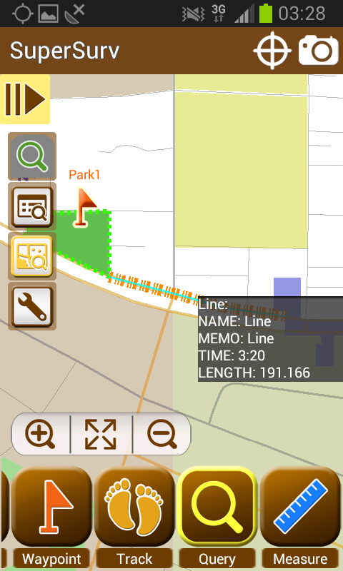
Designed for both iOS and Android powered devices, SuperSurv integrates with GIS and GPS technologies to provide rich functions in field survey, like Map Display, Query, Measure, etc. With SuperSurv, the collected data can be saved as feature layer (point, line, polygon) in SHP or GEO format in offline mode. Besides, SuperSurv supports to employ OpenStreetMap as the base map to make field survey more effective.

With the powerful and user-friendly GIS data collection functions, SuperSurv has been successfully applied in various industries worldwide, like environment protection, pollution prevention, facility management, etc. The free trial version is now available on Apple App store and Google Play, allowing users to experience complete functions within 7 days. The complete version can be purchased on Apple App Store and Google Play as well.

For users in North America, Supergeo especially releases SuperSurv M3 version to provide easy-to-use and useful data collection and map display functions. SuperSurv M3 supports feature layer display and offline editing functions. Furthermore, cached maps can be adopted as the base map to facilitate data capture tasks. Users in North America can find SuperSurv M3 on Google Play and App Store. 

More information of SuperSurv :http://www.supergeotek.com/ProductPage_SuperSurv.aspx

SuperSurv (iOS)https://itunes.apple.com/us/app/supersurv/id734191604?mt=8 
SuperSur M3 (iOS) https://itunes.apple.com/us/app/supersurv-m3-lite/id852187223?ls=1&mt=8

SuperSurv (Android) https://play.google.com/store/apps/details?id=com.supergeo.asd.supersurv_lite.SuperSurv 
SuperSurv M3 (Android)https://play.google.com/store/apps/details?id=com.supergeo.asd.m3_lite.SuperSurv


Filed Under: Mobile Mapping, Field GIS, LBS Tagged With: Field GIS, LBS, Mobile Mapping, News, Smart Mapping SuperSurv Available on App Store and Google Play Now

Editor’s Picks

10 Question GeoGeek Rapidfire – Ted Florence @Avenza

Location Privacy and What you Might be Sharing Over Public WiFi

ESRIUC Notes – Top 10 new features in ArcGIS 10.2

Tripomatic – Custom Maps Built entirely with OpenSource Mapping Tools

See More Editor's Picks...

About Editor

Glenn is a geographer and a GIS professional with over 20 years experience in the industry. He's the co-founder of GISuser and several other technology web publications.

Recent Industry News

The Future of Competitive Gaming: Why DMA Technology is the Ultimate Performance Edge

June 24, 2026 By GISuser

Milwaukee M18FHZ-0 Hackzall Reciprocating Saw – For hardcore cutting in a compact size

June 19, 2026 By GISuser

How Enterprises Are Using AI to Automate 80% of Customer Interactions With Voice Agents

June 16, 2026 By GISuser

Why On Cloud Shoes Are Worth the Price in Mexico

June 16, 2026 By GISuser

Hot News

State of Data Science Report – AI and Open Source at Work

HERE and AWS Collaborate on New HERE AI Mapping Solutions

Virtual Surveyor Adds Productivity Tools to Mid-Level Smart Drone Surveying Software Plan

Categories

Copyright gletham Communications 2015 - 2026

Go to mobile version