GIS user technology news

News, Business, AI, Technology, IOS, Android, Google, Mobile, GIS, Crypto Currency, Economics

  • Advertising & Sponsored Posts
    • Advertising & Sponsored Posts
    • Submit Press
  • PRESS
    • Submit PR
    • Top Press
    • Business
    • Software
    • Hardware
    • UAV News
    • Mobile Technology
  • FEATURES
    • Around the Web
    • Social Media Features
    • EXPERTS & Guests
    • Tips
    • Infographics
  • Blog
  • Events
  • Shop
  • Tradepubs
  • CAREERS
You are here: Home / News / GIS, Geo Tech Software / Orbit Logic Delivers Collection Planning Software to New Customer

Orbit Logic Delivers Collection Planning Software to New Customer

March 20, 2014 By Editor

GREENBELT, MD (March 20, 2014) – Orbit Logic announced today that they will deliver their Collection Planning & Analysis Workstation (CPAW) software to an undisclosed customer for an upcoming satellite imaging system. The customer will initially use CPAW for analysis to help refine the design of their imaging system as well as demonstrate system capabilities to potential customers.  CPAW will later be deployed for lights-out operational planning for the same satellite imaging system.

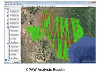
Orbit Logic’s Collection Planning & Analysis Workstation (CPAW) software solves the difficult problem of satellite imagery collection planning through a spacecraft simulator coupled with scheduling algorithms that generate valid and optimized high fidelity imagery collection plans for use in satellite operations, analysis, or imagery ordering. CPAW covers everything from contact scheduling and recorder management to power and antenna modeling while accounting for clouds, terrain, timing constraints, and sensor capabilities. Planning can be completely manual, fully automated, or anywhere in between to plan for anything from a single image on a single satellite to extensive order decks collected by a constellation of multiple EO and SAR spacecraft with varying capabilities.

Orbit Logic (www.orbitlogic.com) specializes in mission planning and scheduling solutions for aerospace and geospatial intelligence. Orbit Logic’s operationally proven COTS products create better plans faster with fewer resources for all mission phases. Orbit Logic engineering services are available to configure, customize, and integrate Orbit Logic’s mobile, web-based, and desktop applications to provide turn-key operational solutions that leverage the latest available technologies to meet customer goals and exceed their expectations


Filed Under: GIS, Geo Tech Software Tagged With: Geo Tech Software, GIS, News, Orbit Logic Delivers Collection Planning Software to New Customer

Editor’s Picks

FireWhat? Mobile GIS Lab, Emergency Incident Mapping and HP Mobile Workstations

Real Earth™ Wins Microsoft Competition for 3D Mapping and Localization

US Army Corps of Engineers Selects SimActive for Drones

Boulder County Launches New Geospatial Open Data Platform

See More Editor's Picks...

About Editor

Glenn is a geographer and a GIS professional with over 20 years experience in the industry. He's the co-founder of GISuser and several other technology web publications.

Recent Industry News

How to Choose the Best Office Interior Designers in Delhi for End-to-End Projects

June 3, 2026 By GISuser

Why Bathroom Renovation Services Often Change More Than Just the Bathroom

May 20, 2026 By GISuser

The Drift Between Early Notes and Final Case Files in Abuse-Related Legal Support

April 29, 2026 By GISuser

Aerial Surveys Int’l and Global Marketing Insights to Present GEOINT 2026 Workshop on Multi-Domain Geospatial Fusion for Automated Infrastructure Monitoring

April 24, 2026 By GISuser

Hot News

State of Data Science Report – AI and Open Source at Work

HERE and AWS Collaborate on New HERE AI Mapping Solutions

Virtual Surveyor Adds Productivity Tools to Mid-Level Smart Drone Surveying Software Plan

Categories

Copyright gletham Communications 2015 - 2026

Go to mobile version