GIS user technology news

News, Business, AI, Technology, IOS, Android, Google, Mobile, GIS, Crypto Currency, Economics

  • Advertising & Sponsored Posts
    • Advertising & Sponsored Posts
    • Submit Press
  • PRESS
    • Submit PR
    • Top Press
    • Business
    • Software
    • Hardware
    • UAV News
    • Mobile Technology
  • FEATURES
    • Around the Web
    • Social Media Features
    • EXPERTS & Guests
    • Tips
    • Infographics
  • Blog
  • Events
  • Shop
  • Tradepubs
  • CAREERS
You are here: Home / environment / Update on OSM Crisis Mappers in the Philippines

Update on OSM Crisis Mappers in the Philippines

November 18, 2013 By Editor

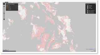
An update from the Heidelberg University describes more than 1.000 OpenStreet Map (OSM) Crisis Mapping Volunteers developing a CrisisMap for the Philippines. The map shows Elements at Risk, population distribution, damaged buildings and Instagram images for Philippines. This update from the team…For supporting the disaster management activities after the typhoon Yolanda/Haiyan a new Crisis Map: http://crisismap.geog.uni- heidelberg.de/ has been set up by GIScience Research Group at Heidelberg University that visualizes map layers as the map layers showing population density and “elements at risk” for the Philipines. Credits for this voluntary effort go to Pascal Neis, Andreas Reimer, Maxim Rylow, Bernd Resch, Günter Sagl, Joao Porto and colleagues.

Note: A Mapathon to support crisis mapping with OpenStreetMap has been organized by Andreas Reimer and colleagues at Heidelberg University on Thursday Nov. 14th 2013.

See more on the University blog

Filed Under: environment, OSM

Editor’s Picks

ArcGIS Online Updates Include Smart Mapping and More

USGS Lidar Base Specification Version 1.2

A Possible Date Conflict with 2016 ESRIUC and the MLB All Star Game

Feature: Social Media Mapping is Crucial for Market Research and your Social Strategy

See More Editor's Picks...

About Editor

Glenn is a geographer and a GIS professional with over 20 years experience in the industry. He's the co-founder of GISuser and several other technology web publications.

Recent Industry News

Why Bathroom Renovation Services Often Change More Than Just the Bathroom

May 20, 2026 By GISuser

The Drift Between Early Notes and Final Case Files in Abuse-Related Legal Support

April 29, 2026 By GISuser

Aerial Surveys Int’l and Global Marketing Insights to Present GEOINT 2026 Workshop on Multi-Domain Geospatial Fusion for Automated Infrastructure Monitoring

April 24, 2026 By GISuser

Why Timing Matters More Than You Think With Spray Seal (And Why People Often Get It Slightly Wrong)

April 22, 2026 By GISuser

Hot News

State of Data Science Report – AI and Open Source at Work

HERE and AWS Collaborate on New HERE AI Mapping Solutions

Virtual Surveyor Adds Productivity Tools to Mid-Level Smart Drone Surveying Software Plan

Categories

Copyright gletham Communications 2015 - 2026

Go to mobile version