Supergeo announced that SuperSurv 3.1a Beta, the GIS data collection application for Android, is released today.
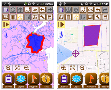
SuperSurv is the mobile GIS application specially designed for field survey. Integrating with GIS and GPS technologies, SuperSurv can be applied Android devices. The main functions of SuperSurv include data collection, positioning and map display. Besides, the data of point, line and polygon that users collect with SuperSurv can be saved in commonly-used vector data formats (SHP and GEO).
The newest SuperSurv 3.1a mainly enhances the connection with SuperGIS Server 3.1a map service. Users can load the maps published by SuperGIS Server 3.1a through the Internet while conducting field surveys. And users can also transmit the collected spatial data and attribute data to the server to update and share data immediately. In addition, Online Map Tool built in SuperSurv 3.1a can be applied to utilize OpenStreetMap as the basemap for data collection to improve the efficiency.
SuperSurv 3.1a adds Spanish interface to support Spanish native speakers to view maps and collect data. Now, SuperSurv 3.1a supports diverse interface languages including traditional Chinese, English, Italian, French and Spanish.
To obtain the free trial of the newest SuperSurv 3.1a Beta, you can download it on Supergeo website: http://www.supergeotek.com/download_6_mobile.aspx.