SuperGIS Server 3.1 Standard Edition will be launched in Q4 this year
SuperGIS Server is designed to enable the organizations to create, manage, integrate and publish the various types of GIS services. Through it, the spatial data and spatial images in all types as well as GIS functions can be applied as GIS services in desktop, mobile and web applications over the Internet.
Providing essential functions like geographic data management, integration and publishing, SuperGIS Server 3.1 Value Edition can assist developers to build map website effectively. In addition, SuperGIS Server 3.1 Value Edition also integrates map services from other sources such as Google Map, OpenStreetMap and ArcGIS Online.
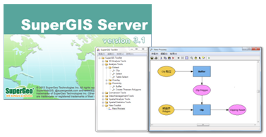
The newest SuperGIS Server 3.1 Standard Edition supports to publish Geoprocessing Service. Service providers are able to create geoprocessing functions and workflow with SuperGIS Toolkit in SuperGIS Desktop, and then publish the defined functions and workflows to website through SuperGIS Server. Therefore, SuperGIS Server map website can not only provide essential functions like map display, query, edit and so forth but also geoporcessing functions for users to apply with the map data on the website instantly. As a result, the shareability of spatial data analyses can be enhanced as well.
SuperGIS Server 3.1 Standard Edition will be launched in Q4 of 2012. To know more about the related products, please visit SuperGeo website: www.supergeotek.com, or contact us by e-mail: staff@supergeotek.com.