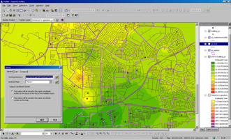
SuperGeo announces that SuperGIS Spatial Analyst 3 is officially released worldwide. The latest extension contains a number of spatial modeling and analysis algorithms and provides friendly user interface to help user effectively complete complicated spatial analysis tasks.
The latest version of SuperGIS Spatial Analyst 3.0 supports to import point, line, polygon, and raster data for some specific functions. Moreover, Hydrologic analysis is supported, including basin, fill, flow accumulation, flow direction, flow length, sink, snap pour point, stream link, stream order, and watershed. Consequently, users are allowed to perform the data in various formats and complete comprehensive spatial analysis.
The details of the new features in SuperGIS Spatial Analyst 3.0 are listed in "What’s New in SuperGIS Spatial Analyst 3.0". For the latest document and software, please visit SuperGeo website to download the trial.
In addition, Users need to use Spatial Analyst 3.0 with SuperGIS Desktop 3.1, and other extensions, such as SuperGIS Network Analyst 3.0, are going to be launched in the near future. For more information, please contact us (staff@supergeotek.com).