It was great to have a chance to take in a local GIS event this week, thanks to the GIS Alley team and the local GIS user community here in Fort Collins and the NOCO Front Range. Last night in FT CO the first annual (we hope) GIS Day event organized by GIS Alley took place at the Drake Center and I’m guessing there was close to 100 local GIS professionals & enthusiasts in attendance.
We enjoyed some great finger food (my son killed the meatball plate!) a couple of drinks and some good conversation in a room filled with local GIS companies exhibiting their technologies (Red Hen Systems, Cartopac Field Solutions, TechniGraphics, cci, ESC Engineering) and a few brave map makers who shared some of their latest works via a poster display.The highlight of the night was a welcome address from the Mayor of Fort Collins (who also has a history in Geospatial technologies), some fun GIS trivia, and a fine presentation by Carl Reed, CTO of the OGC… a Fort Collins "old timer" and GIS pioneer in this area. Recall, Reed was recently inducted into the URISA Hall of Fame.
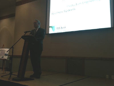

City of Fort Collins Mayor, Doug Hutchinson welcomes attendees to the GIS Day event
Carl took the stage for about 20 minutes to share his story about the history of GIS in Fort Collins… a very interesting discussion indeed! I found it very interesting in particular as Carl himself is somewhat responsible for my presence in Fort Collins and so much of what he discussed really struck home for me. You likely aren’t aware of my history, however, it was back in the mid-1990’s when I was a GIS Analyst with an environmental consulting firm in B.C., Canada. At the we were a GenaMap (Genasys) shop, providing services to the B.C Provincial Government who had adopted Genasys as the Provincial standard platform for their enterprise GIS needs. Well, as luck would have it, Genasys (I believe Carl was the CEO at the time) had their North American HQ in Fort Collins. I was several trips to the Front Range for Genamap user conferences that introduced me to the area and subsequently encouraged me to relocate here with my family – loads of sunshine, a tech-savvy, young population, and a vibrant GIS user community were made the region an ideal place for me to setup shop for Spatial Media in 2003.
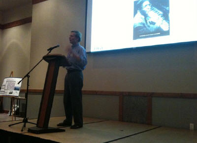

Carl Reed’ taking the stage at gisalley gisday
Back to Carl’s GIS Day presentation, Carl took us through his experiences and a discussion of what brought him to Fort Collins. It was back in the mid 70’s when the USFWS WELUT team established their offices in Drake Park, Fort Collins. Projects such as an RFP for GIS Habitat Mitigation (funded by the EPA) and the development of a wetlands analytical mapping system for MOSS that really drove the GIS Innovation in the region and resulted in a growing need for GIS professionals in Fort Collins to support these projects. Eventually, WELUT grew as a service center of GIS support services and after several years saw the development of a wetlands change detection system for Louisiana which was used in congressional hearings… this really put NOCO’s GIS activities on the map!
The rest is history as a number of GIS service providers grew over time, many of them (and the long time staffers) are still working diligently on GIS projects here in GIS Alley.
Note, after 2 years of promoting the GIS industry in NOCO, GIS Alley currently has more than 50 member companies who are enjoying the rewards of an industry that is realizing 35% annual growth (according to Reed) and is considered to be a Mega-Technology heading into the 21st century.
Remember, GIS Day is November 18, 2009!
Related GIS Resources:
- www.GISAlley.com
- www.gisday.com
- http://www.opengeospatial.org/
- OGC’s CTO, Carl Reed, Inducted into URISA Hall of Fame
- NOCO GIS Technology LinkedIn Group
- GIS Alley is proud to present its first GIS Day celebration November 12th, Fort Collins, Colorado
Related Twitter Comments
