GIS user technology news

News, Business, AI, Technology, IOS, Android, Google, Mobile, GIS, Crypto Currency, Economics

  • Advertising & Sponsored Posts
    • Advertising & Sponsored Posts
    • Submit Press
  • PRESS
    • Submit PR
    • Top Press
    • Business
    • Software
    • Hardware
    • UAV News
    • Mobile Technology
  • FEATURES
    • Around the Web
    • Social Media Features
    • EXPERTS & Guests
    • Tips
    • Infographics
  • Blog
  • Events
  • Shop
  • Tradepubs
  • CAREERS
You are here: Home / Archives for book

New Esri Book Helps Public Safety Agencies Get Started with GIS Technology

February 12, 2022 By GISuser

Smart Maps, Dashboards, and Location Data Analysis Have Become Mission-Critical Tools

Filed Under: Business, Top Text Lead Story Tagged With: book, ESRI, Public Safety

Esri Book Demonstrates How Maps Enable Cross-Sector Civic Collaboration

January 13, 2022 By GISuser

Geospatial Technology Can Bring Leaders from Different Perspectives Together to Address Community Challenges

Filed Under: Business Tagged With: book, ESRI, Government

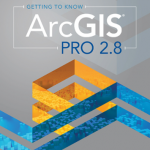
New Esri Book Provides Beginners a Guide for Location Analytics
January 5, 2022 By GISuser

Getting to Know ArcGIS Pro 2.8 

Getting to Know ArcGIS Pro 2.8 Shows New Users How to Make Sense of Data with GIS

Filed Under: Business, EDU, Featured TOP PR, Top Text Lead Story Tagged With: arcgis, book

Esri Releases GIS for Science, Volume 3

November 29, 2021 By GISuser

New Book Showcases Applications of Location Intelligence for Conservation Initiatives

Filed Under: Business, EDU Tagged With: arcgis, book, ESRI

Esri Releases ArcGIS Pro Book Updated for Version 2.8

August 31, 2021 By GISuser

Guide Includes the Latest ArcGIS Pro Tools and Workflows with Proven Instructional Strategies

Filed Under: Business, EDU, Top Press Tagged With: arcgis, book, ESRI

Esri Releases Book That Is a Call to Action for Conservation

July 6, 2021 By Editor

A Guide for Modern Strategies to Achieve Environmental Equity and Sustainability

Filed Under: Environment Tagged With: arcgis, book, conservation, environment

Esri Publishes Children’s Book Introducing Site Selection to Youth Audience

May 29, 2021 By Editor

Image Credit, Esri - The Playground Problem

Finding the Best Place for a New Playground

Filed Under: Business, EDU, Top Press Tagged With: arcgis, book, Education

Esri Releases New Book for Utilities Getting Started with GIS

March 24, 2021 By Editor

Applying Spatial Analytics to Water and Power Services

Filed Under: Business, UTILITIES Tagged With: arcgis, book, ESRI, Utilities

New Esri Book Describes Crime Analysis for a Broad Audience

February 25, 2021 By Editor

Understanding Crime Allows Anyone to Understand Geospatial Approaches to Law Enforcement

Filed Under: Business Tagged With: arcgis, book, crime

Esri Releases New Book on Applying GIS to Resiliency Planning

February 22, 2021 By Editor

How Geography Can Bring Insight to Communities Facing a Turbulent World

Filed Under: Business Tagged With: arcgis, book

« Previous Page
Next Page »

Top Press

The Global Expansion of Aueshah: A New Era of High Jewelry

April 11, 2026 By GISuser

KARACHI, PAKISTAN. The international luxury market is experiencing a profound shift. Consumers are increasingly rejecting mass-produced goods in favor of rarity, authenticity, and emotional depth. … [Read More...]

State of Data Science Report – AI and Open Source at Work

September 10, 2025 By GISuser

AI and Open Source at Work … [Read More...]

Topcon Announces Landmark Expansion of Topnet Live Network Across USA

January 26, 2025 By GISuser

LIVERMORE, Calif.---Topcon Positioning Systems has announced a significant expansion of its Topnet Live reference station network, introducing 200 new geodetic stations strategically positioned across … [Read More...]

Space Flight Laboratory (SFL) Announces Launch and Deployment of NorSat-4 Maritime Monitoring Microsatellite

January 19, 2025 By GISuser

Seventh Satellite Developed by SFL for Norway … [Read More...]

HERE and BMW Group extend partnership on AI-powered mapping system

January 8, 2025 By GISuser

HERE and BMW Group extend partnership on AI-powered mapping system for automated driving and enhanced road safety … [Read More...]

Beyond the Map: How AI Image and Video Generation Is Changing Geospatial Communication

October 14, 2026 By GISuser

Ask anyone who has shipped a GIS project what the hardest part was, and the answer is rarely the spatial analysis. It is almost always the communication. A site suitability … [Read More...]

From Maternity to Everyday Wear: Building a Wardrobe That Grows With You

October 14, 2026 By GISuser

When I think about maternity clothing, I feel the biggest mistake is buying too many things at once. During pregnancy, your body keeps changing, and something that fits well today … [Read More...]

eMMC 5.1 Explained: Features, Performance, and Applications in Modern Devices

October 14, 2026 By GISuser

Storage technology is an essential part of modern computing, influencing how devices store information, launch applications, and manage everyday workloads. Although … [Read More...]

SFL Missions Inc. Confirms Successful Deployment of Two GHGSat Greenhouse Gas Monitoring Microsatellites

October 3, 2026 By GISuser

TORONTO, Ontario, Canada, 2 October 2026 – SFL Missions Inc. confirms the successful launch and deployment of the GHGSat-C18 (Eleanor) and GHGSat-C19 (Aidan) commercial greenhouse … [Read More...]

GIS Cloud user growth doubles as AI-powered geospatial intelligence outpaces specialist capacity

September 29, 2026 By GISuser

More than 100 new users join the platform every day, driven by demand for AI-powered geospatial intelligence  Asterra, Pipe View America and InfraTrace among organisations to … [Read More...]

Copyright gletham Communications 2015 - 2026

Go to mobile version