GIS user technology news

News, Business, AI, Technology, IOS, Android, Google, Mobile, GIS, Crypto Currency, Economics

  • Advertising & Sponsored Posts
    • Advertising & Sponsored Posts
    • Submit Press
  • PRESS
    • Submit PR
    • Top Press
    • Business
    • Software
    • Hardware
    • UAV News
    • Mobile Technology
  • FEATURES
    • Around the Web
    • Social Media Features
    • EXPERTS & Guests
    • Tips
    • Infographics
  • Blog
  • Events
  • Shop
  • Tradepubs
  • CAREERS
You are here: Home / Archives for Remote Sensing , Earth Imaging

3-D digital scanning feature – Capturing History at Mount Rushmore

May 28, 2010 By Editor

(Keystone, SD) Despite the snow and rain from the past week, the 3-D digital scanning project at Mount Rushmore National Memorial has captured some impressive data from the scans.

Filed Under: Remote Sensing , Earth Imaging Tagged With: 3-D digital scanning feature - Capturing History at Mount Rushmore, Articles, Earth Imaging - Remote Sensing

Surrey Embraces the Open Data Initiative

April 1, 2010 By Editor

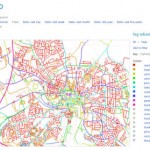
Surrey Embraces the Open Data Initiative – Local Authorities and Communities to Benefit From Public Domain Aerial Photography 

Filed Under: Remote Sensing , Earth Imaging Tagged With: opendata, Select Category, Select Section

Amerisurv Spotlight – Eye In The Sky: A Visit to GeoEye

December 7, 2009 By Editor

From The American Surveyor Magazine…  The Editor pays a visit to the headquarters of Earth Imagine leader, GeoEye.

Filed Under: Remote Sensing , Earth Imaging Tagged With: Amerisurv Spotlight - Eye In The Sky: A Visit to GeoEye, Articles, Earth Imaging - Remote Sensing

Visualizing National Geodetic Survey Control Stations in Google Earth

November 18, 2009 By Editor

Google Earth is rapidly becoming the land surveyor’s tool-of-choice for preliminary job site reconnaissance and survey planning (see "Topography is Dead," by Joel Leininger, March 2007). Survey projects often begin with the investigation and selection of nearby NGS marks to establish horizontal and vertical control.

Filed Under: Remote Sensing , Earth Imaging

Commercial data sales top $1 billion in 2009 for Earth observation sector

November 12, 2009 By Editor

According to Euroconsult’s new report Satellite-Based Earth Observation, Market Prospects to 2018 there will be over $1 billion in annual data sales in 2009 – a figure expected to nearly quadruple by 2018 – indicating the commercial Earth observation sector is establishing itself as a legitimate source of revenue growth for the global economy.

Filed Under: Remote Sensing , Earth Imaging Tagged With: Articles, Commercial data sales top $1 billion in 2009 for Earth observation sector, Earth Imaging - Remote Sensing

« Previous Page

Recent Industry News

Why Bathroom Renovation Services Often Change More Than Just the Bathroom

May 20, 2026 By GISuser

The Drift Between Early Notes and Final Case Files in Abuse-Related Legal Support

April 29, 2026 By GISuser

Aerial Surveys Int’l and Global Marketing Insights to Present GEOINT 2026 Workshop on Multi-Domain Geospatial Fusion for Automated Infrastructure Monitoring

April 24, 2026 By GISuser

Why Timing Matters More Than You Think With Spray Seal (And Why People Often Get It Slightly Wrong)

April 22, 2026 By GISuser

Hot News

State of Data Science Report – AI and Open Source at Work

HERE and AWS Collaborate on New HERE AI Mapping Solutions

Virtual Surveyor Adds Productivity Tools to Mid-Level Smart Drone Surveying Software Plan

Categories

Copyright gletham Communications 2015 - 2026

Go to mobile version