March 6, 2018 – Today the 3rd Annual UAS Symposium was kicked off in Baltimore, Maryland as Acting Administrator Dan Elwell announced the Federal Aviation Administration (FAA) is expanding tests of an automated system that will ultimately provide near real-time processing of airspace authorization requests for unmanned aircraft (UAS) operators nationwide.
Cansel to Distribute Microdrones Fully Integrated Drone Systems Throughout Canada
VAUDREUIL-DORION, Quebec, March 28, 2018 — Leading geospatial solutions provider, Cansel, signed an agreement to distribute Microdrones integrated systems. With 23 locations and a strong reputation dating back to 1966, Cansel is firmly positioned to help customers adopt drone technology for geospatial applications.
Commercial UAV Expo Europe Announces Exhibitors to Date
Best-in-class solutions providers to exhibit at second annual drone trade fair and conference 10-12 April in Amsterdam
How Drones Are Changing The World
We live in the technological revolution, where advances in computer technology and electrical engineering innovations are changing every aspect of our lives, from how we travel to how we work and how we spend our leisure time. Drones have made a particularly noticeable impact over the last few years. As they become ever more affordable, […]
Wingtra sets a new benchmark in drone photogrammetry
Zürich, 27 February 2018: With the launch of WingtraOne PPK (Post-Processed Kinematics) drone, the Swiss UAV manufacturer Wingtra is setting a new benchmark in large scale surveying and mapping applications. With the help of its industry-leading partners – photogrammetry software provider Pix4D, and the GNSS board and PPK provider Septentrio – WingtraOne PPK is now able […]
The UAS Symposium is Flying Your Way
The Federal Aviation Administration (FAA) and the Association for Unmanned Vehicle Systems International (AUVSI) will co-host the 3rd Annual FAA Unmanned Aircraft Systems (UAS) Symposium on March 6-8, 2018 at the Baltimore Convention Center, Baltimore, MD.
Geomni Launches New Mobile App for Ground Imagery and Drone Inspections
Users can perform a complete UAV inspection from the safety of the ground
A new infographic from Dronefly.com explains: How are drones being used for agriculture?
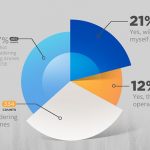
Dronefly.com has released its third infographic on drone use applications. This time they discuss one of the largest addressable commercial market segment: agriculture.
Woolpert Partners with Savannah/Hilton Head International Airport on Drone Utilization

SAVANNAH, Ga. (Feb. 12, 2018) — Savannah/Hilton Head International Airport (SAV) is partnering with Woolpert to integrate unmanned aircraft system (UAS) technologies into airport and airfield operations.
AirGon LLC Appointed North American Distributor for YellowScan Drone LIDAR Systems
Huntsville, AL – AirGon LLC, a wholly owned subsidiary of GeoCue Group Inc., has been appointed the North American Distributor for YellowScan, based in Montpellier, France.