The National Atlas of the Arctic now available from East View
Esri and DigitalGlobe Provide Unprecedented View of World Cup
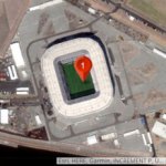
High-Resolution Images Coupled with Esri Story Maps Apps Walk through Arenas
Webinar – 3 Key Elements for Making Good Maps Great

Visual representation is as much an art as a science. Making high-quality maps that convey the most relevant information while maintaining a design that is easy to interpret is a challenge that is familiar to anyone who works with GIS data.
Story Map – Mapping the Two Koreas
This Esri story Map reveals Uneasy Asian neighbors share a history of tension and conflict.
Esri Story Map Explores Communities Potentially Impacted by Changes to Immigration Policy
When elected officials talk about changing our immigration system, just who and where are people affected?
Esri Story Map Explores Communities Potentially Impacted by Changes to Immigration Policy
When elected officials talk about changing our immigration system, just who and where are people affected? That’s the question Esri is trying to help answer with a new interactive story map that explores communities with the highest shares of non-citizen residents and DACA recipients.
New Map of Worldwide Croplands Supports Food and Water Security
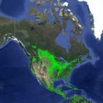
India has the highest net cropland area while South Asia and Europe are considered agricultural capitals of the world.
Esri Maps Highlight Holiday Traffic around Major Airports

Holiday travel means long wait times and delays for millions of air travelers. But the communities around America’s biggest airports are also impacted this time of year. Using historical traffic data from HERE, Esri has analyzed traffic trends from the past three years for December 23 (a peak travel day).
Mapping Net Neutrality Implications – The State of Internet Access
Esri Maps Highlight Net Neutrality Implications — With discussions about net neutrality intensifying, Esri has created a suite of interactive maps to illustrate the current state of the Internet access and behavior across the US. From analyzing predominant Internet connection types to highlighting the communities that have already been left behind in the digital divide, […]
New Map of Worldwide Croplands Supports Food and Water Security
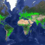
India has the highest net cropland area while South Asia and Europe are considered agricultural capitals of the world