SAN FRANCISCO, May 23, 2012 – A ground-breaking park rating system developed by The Trust for Public Land ranks San Francisco, Sacramento, Boston and New York as the nation’s top city park systems. Mesa (Arizona), Louisville, Charlotte and Fresno received the lowest ParkScores among the 40 largest U.S. cities. ParkScore is the most comprehensive park […]
WSSA Says Online Databases and Smartphone Apps Make it Easier than Ever to Track Invasive Weeds
Lawrence, KS May 21, 2012 Online databases and new smartphone applications are making it easier than ever to track and map infestations of invasive weeds, the Weed Science Society of America (WSSA) said today. “These new resources are moving pockets of information out of universities and laboratories and into the public domain where they are […]
Canada to Shut Down Canada’s Experimental Lakes Area – A World-Renown Aquatic Research Facility
London 3D Tree Map Helps Assess Green Infrastructure
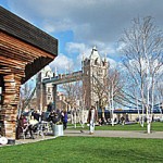
Coalville, Leicestershire, 01 May 2012 – A digital map of trees created by aerial mapping company Bluesky is helping to support a range of environmental projects in London. Using Bluesky’s tree map The Ecology Consultancy (TEC) and the Green Roof Consultancy (GRC) have undertaken a Green Infrastructure (GI) Audit on behalf of Hammersmith London Business […]
Hershey Announces GPS Project to Map Cocoa Farms in Ghana
Using Technology to Increase Farmer Incomes and Improve Communities
15 Agricultural Innovations Protecting the Environment on Earth Day
This Earth Day, Worldwatch’s Nourishing the Planet project highlights 15 sustainable agricultural practices that are protecting the environment while also improving people’s livelihoods.
New Water Calculator Launched by Growing Blue
Free tool helps water managers identify ways to reduce impact on local water resources and save money
Green Map® System is Charting the Way to a Sustainable Future!
NEW YORK, April 12, 2012 — To help answer the question, How Green is My City?, the original Green Map of NYC was published 20 years ago. This "Green Apple Map" shared a fresh perspective on natural, cultural and green living resources. Informing New Yorkers as well as visitors, this map quickly gained global attention, sparking […]
Green Map System is Charting the Way to a Sustainable Future
April 12, 2012 — — To help answer the question, How Green is My City?, the original Green Map of NYC was published 20 years ago. This "Green Apple Map" shared a fresh perspective on natural, cultural and green living resources. Informing New Yorkers as well as visitors, this map quickly gained global attention, sparking the […]
Sierra Club, Sewall and Greenleaf Advisors Launch SmartSiting Project in Great Lakes
First-of-its-kind regional web-based GIS will help identify wind project sites