GIS user technology news

News, Business, AI, Technology, IOS, Android, Google, Mobile, GIS, Crypto Currency, Economics

  • Advertising & Sponsored Posts
    • Advertising & Sponsored Posts
    • Submit Press
  • PRESS
    • Submit PR
    • Top Press
    • Business
    • Software
    • Hardware
    • UAV News
    • Mobile Technology
  • FEATURES
    • Around the Web
    • Social Media Features
    • EXPERTS & Guests
    • Tips
    • Infographics
  • Blog
  • Events
  • Shop
  • Tradepubs
  • CAREERS
You are here: Home / * PRESS / LiDAR / Down to Earth – Drone Lidar Surveying Reality Series Returns

Down to Earth – Drone Lidar Surveying Reality Series Returns

February 17, 2021 By Editor

Down to Earth – Drone Lidar Surveying Reality Series Returns – “Down to Earth” is a reality series that shows how real surveyors collect data and turn it into real deliverables, despite challenging conditions, rugged terrain and lurking danger.

REAL SURVEYORS. REAL WORK. REALLY GOOD DATA

REAL SURVEYORS. REAL WORK. REALLY GOOD DATA

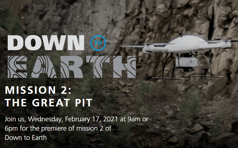
Down to Earth is stepping out of the office and over the edge of the Great Pit in Falun Sweden. Watch as the engineering company Sweco uses drone surveying equipment from Microdrones to survey the Falun Mine to help uncover any hidden settlements, land shifts or other terrain hazards lurking in the grounds of the historic attraction.

“Down to Earth” is a reality series that shows how real surveyors collect data and turn it into real deliverables, despite challenging conditions, rugged terrain and lurking danger.

Check it out HERE

Filed Under: LiDAR, Top Press, UAV/UAS Tagged With: lidar, UAV, Video

Editor’s Picks

JavaScript: Best Practice

JavaScript: Best Practices

Dev Tip- The JavaScript Anthology: 101 Essential Tips, Tricks & Hacks

Social Media is an Increasingly Important Part of Webmaps, Data Analysis, Analytics and Visualizations

NASA, NOAA Find 2014 Warmest Year in Modern Record

See More Editor's Picks...

About Editor

Glenn is a geographer and a GIS professional with over 20 years experience in the industry. He's the co-founder of GISuser and several other technology web publications.

Recent Industry News

The Drift Between Early Notes and Final Case Files in Abuse-Related Legal Support

April 29, 2026 By GISuser

Aerial Surveys Int’l and Global Marketing Insights to Present GEOINT 2026 Workshop on Multi-Domain Geospatial Fusion for Automated Infrastructure Monitoring

April 24, 2026 By GISuser

Why Timing Matters More Than You Think With Spray Seal (And Why People Often Get It Slightly Wrong)

April 22, 2026 By GISuser

The Quiet Planning Stage Most People Don’t See When Building a Pool in Brisbane

April 22, 2026 By GISuser

Hot News

State of Data Science Report – AI and Open Source at Work

HERE and AWS Collaborate on New HERE AI Mapping Solutions

Virtual Surveyor Adds Productivity Tools to Mid-Level Smart Drone Surveying Software Plan

Categories

Copyright gletham Communications 2015 - 2026

Go to mobile version