GIS user technology news

News, Business, AI, Technology, IOS, Android, Google, Mobile, GIS, Crypto Currency, Economics

  • Advertising & Sponsored Posts
    • Advertising & Sponsored Posts
    • Submit Press
  • PRESS
    • Submit PR
    • Top Press
    • Business
    • Software
    • Hardware
    • UAV News
    • Mobile Technology
  • FEATURES
    • Around the Web
    • Social Media Features
    • EXPERTS & Guests
    • Tips
    • Infographics
  • Blog
  • Events
  • Shop
  • Tradepubs
  • CAREERS
You are here: Home / * PRESS / Business / Delair announces subscription program for high performance UX11 & UX11 Ag surveying and mapping drones and delair.ai software platform

Delair announces subscription program for high performance UX11 & UX11 Ag surveying and mapping drones and delair.ai software platform

July 11, 2019 By GISuser

Delair Takeoff offers fixed monthly fee for enhanced flexibility, lower capital expenditure for leveraging long-range, precision aerial intelligence platform
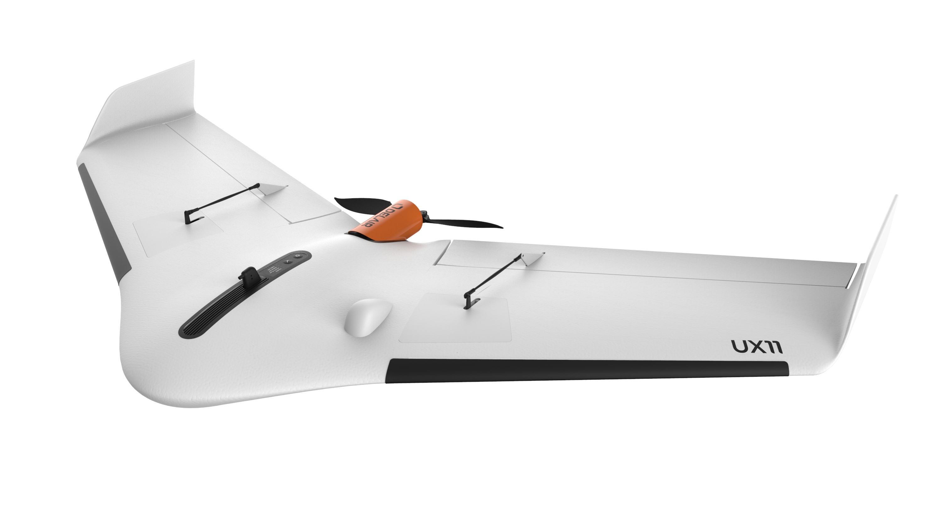
TOULOUSE, France – July 11, 2019 – Delair, a leading supplier of commercial drone solutions, today announced Delair Takeoff, a cost-effective subscription program for accessing the company’s high performance Delair UX11 family of UAVs and its delair.ai, cloud-based data management solution. Customers can pay a fixed monthly fee and have unlimited use of the long-range, fully equipped drone. A six-month minimum contract is required, and the plan is currently only available to customers in Europe.

The program provides a 48-hour drone replacement guarantee in case of an accident, with limited out-of-pocket cost in case of user error or accidental damages.

“This Delair Takeoff program provides the ultimate in flexibility, predictability, and cost-effectiveness for customers who don’t want to lay out an upfront capital expense for a high-performance drone platform. Delair is providing a new level of accessibility for commercial drone users who need to incorporate highly precise and insightful aerial intelligence into their business operations,” said Chase Fly, Delair UX11 Product Manager.

The Delair UX11 is a state-of-the-art drone solution for highly precise and efficient mapping. It delivers integrated features for before, during and after flight operations, including an embedded global shutter camera, centimeter-level precision GNSS sensor, post processed kinematic (PPK) capabilities for survey-grade results, and both 2.4 GhZ wireless and 3G/4G cellular connectivity to operate anywhere. The drone’s operational performance allows flights of up to 59 minutes covering over 300 acres at 400 feet. The Delair UX11 Ag model is custom-built for agriculture and vegetation management and is unique in that it provides the industry’s best grade multispectral data with PPK positioning which enables precise georeferencing for repeatable analysis of individual plants, a tremendous benefit for applications such as seed breeding, precision agriculture, or range management.

Delair UX11 users can also access delair.ai, a cloud-based platform that helps users manage, process, view, analyze and collaborate around aerial data. Delair’s industry-specific solutions provide the simplicity, security, and scalability that enterprises require to turn aerial data into business insights. and models as well as to use advanced analytics like verified stockpiles, haul roads, lidar classification and much more. 

Pricing for Delair Takeoff starts at €1250/month. Complete pricing information on Delair UX11 can be found here.

About Delair

Delair is a leading provider of end-to-end, drone-based solutions that enable enterprises to digitize their physical assets and turn the collected data into valuable business insights. The company’s offerings combine high performance, long range fixed-wing UAV hardware with Delair Aerial Intelligence (delair.ai), the industry’s most powerful platform to manage, analyze and share aerial data. Its solutions are sold in over 70 countries with a network of more than 100 resellers in industries such as mining, construction, agriculture, oil and gas, utilities and transportation. Delair has strengthened its position as a global leader through strategic acquisitions (Gatewing, Airware/Redbird), and a strategic investment by Intel Corporation. Founded in 2011 by experts in the aerospace industry, the company employs 180 people and has offices in Toulouse, Paris, Los Angeles, Beijing and Singapore. For more information, go to www.delair.aero.

Filed Under: Business, UAV/UAS

Top Press

The Global Expansion of Aueshah: A New Era of High Jewelry

April 11, 2026 By GISuser

KARACHI, PAKISTAN. The international luxury market is experiencing a profound shift. Consumers are increasingly rejecting mass-produced goods in favor of rarity, authenticity, and emotional depth. … [Read More...]

State of Data Science Report – AI and Open Source at Work

September 10, 2025 By GISuser

AI and Open Source at Work … [Read More...]

Topcon Announces Landmark Expansion of Topnet Live Network Across USA

January 26, 2025 By GISuser

LIVERMORE, Calif.---Topcon Positioning Systems has announced a significant expansion of its Topnet Live reference station network, introducing 200 new geodetic stations strategically positioned across … [Read More...]

Space Flight Laboratory (SFL) Announces Launch and Deployment of NorSat-4 Maritime Monitoring Microsatellite

January 19, 2025 By GISuser

Seventh Satellite Developed by SFL for Norway … [Read More...]

HERE and BMW Group extend partnership on AI-powered mapping system

January 8, 2025 By GISuser

HERE and BMW Group extend partnership on AI-powered mapping system for automated driving and enhanced road safety … [Read More...]

Everest Base Camp Helicopter Tour, Helicopter Return Trek, and Manaslu Circuit Trek: Which Nepal Adventure Is Right for You?

November 6, 2026 By GISuser

Almost everyone planning a Nepal trip runs into the same wall. You want the big mountains, you have a fixed number of days, and every itinerary you read seems to promise something … [Read More...]

SFL Missions Inc. Confirms Successful Deployment of Six HawkEye 360 Radio Frequency Detection Satellites with Advanced Capabilities

October 27, 2026 By GISuser

MĀHIA, New Zealand, 26 October 2026 – SFL Missions Inc. today confirmed the successful deployment of six radio frequency (RF) detection and geolocation satellites for HawkEye 360 … [Read More...]

Canadian-Built RoadEng 12 Uses AI to Find the Best Location for New Resource and Rural Roads

October 17, 2026 By GISuser

Vancouver, BC, Canada, October 15, 2026 – North Vancouver-based Softree Technical Systems today released RoadEng Version 12, used in more than 75 countries to locate and design … [Read More...]

Beyond the Map: How AI Image and Video Generation Is Changing Geospatial Communication

October 14, 2026 By GISuser

Ask anyone who has shipped a GIS project what the hardest part was, and the answer is rarely the spatial analysis. It is almost always the communication. A site suitability … [Read More...]

From Maternity to Everyday Wear: Building a Wardrobe That Grows With You

October 14, 2026 By GISuser

When I think about maternity clothing, I feel the biggest mistake is buying too many things at once. During pregnancy, your body keeps changing, and something that fits well today … [Read More...]

Copyright gletham Communications 2015 - 2026

Go to mobile version