During the 2019 Esri User Conference in San Diego, ikeGPS will be showcasing Spike at their booth – demoing the latest features from Spike’s integration with Esri’s Survey123 for ArcGIS®, and sharing teasers for upcoming integrations. Just one year after first introducing Spike’s integration with Survey123, ikeGPS was honored to receive the 2019 Esri Partner Conference Improving Field Operations Award.
Update Your Geodatabase from Your Mobile Device with a Smart Laser and Smart Forms
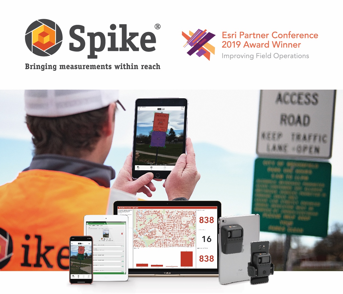
Spike is an affordable and easy to use smart laser measurement solution that is seamlessly integrated with Esri’s Survey123 mobile app. This integrated solution is designed for the novice to intermediate user, so you can train anybody to go into the field and capture the data you need to complete your project on time and on budget. Common applications include transportation, code compliance, sign inventory, asset management, and tax assessments.
Point-to-Point Measurements Now Integrated with Survey123
Spike’s Point-to-Point Measurement capability is now part of Spike’s integration with Survey123. Esri users can benefit from Spike’s four key measurement capabilities:
- Photo Measure: measure elevations, lengths, and areas of objects from a single photo, such as walls, windows, or signs.
- Point-to-Point: measure the distance between two objects in seconds by capturing two photos, such as tree heights, road widths, and setbacks.
- Offset GPS Location: capture a target’s location, your location, and a georeferenced image of the target, simply by taking a photo from a safe distance.
- Distance to Target: measure the distance between your mobile device and the photographed object.
Learn more at: ikegps.com/esri-survey123
Coming Soon: Spike Integration with Esri’s Collector for ArcGIS® – Call for Contributors
Building on the proven integration of the Spike laser measurement device with ArcGIS, ikeGPS is pleased to that we will begin working on an integration between Spike and Esri’s premier field data collection app, Collector. Integration development between the two apps is planned for late 2019 and is forecasted to be ready in time for the 2020 field season.
ikeGPS is now inviting the Spike and Esri user communities to participate in a feedback working group to support the development of the integration. By participating in this group, users will be able to provide their requirements for this integration, contribute to development, and be part of beta testing. To sign up to the working group, please visit the ikeGPS booth #2331 at the Esri UC.
Learn more about Spike, and upcoming feature releases for Spike, by visiting the ikeGPS booth at the Esri UC – #2331.