GIS user technology news

News, Business, AI, Technology, IOS, Android, Google, Mobile, GIS, Crypto Currency, Economics

  • Advertising & Sponsored Posts
    • Advertising & Sponsored Posts
    • Submit Press
  • PRESS
    • Submit PR
    • Top Press
    • Business
    • Software
    • Hardware
    • UAV News
    • Mobile Technology
  • FEATURES
    • Around the Web
    • Social Media Features
    • EXPERTS & Guests
    • Tips
    • Infographics
  • Blog
  • Events
  • Shop
  • Tradepubs
  • CAREERS
You are here: Home / * PRESS / Business / Four Ways Maptitude 2019 Saves You Time & Money

Four Ways Maptitude 2019 Saves You Time & Money

April 23, 2019 By Editor

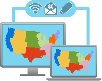
NEWTON MA (USA) – Business analysts need to quickly manage and share their maps and data within their team.

Franchisors and retailers need their maps to be updated with their latest corporate data. Hospitals and banks need the most up-to-date demographic information. Maptitude 2019 makes it easier than ever to meet these needs. Here are 4 key areas where Maptitude 2019 will prove to be critical to your organization:

  1. Simple File Management: No more layer saving. No more window saving. Just a simple single file for managing and sharing each project. Maptitude 2019 also now supports auto-saving in case you lose your work or forget to save it, and file-locking to prevent accidental file overwriting by other users.
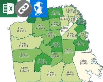
  2. Data Linking & Updating: No more importing/copying your tables into Maptitude. Continue managing your data in Excel or SQL Server and use linking to update your maps with any changes in your external tables. Maptitude 2019 now supports linking for boundaries as well as for pushpin locations.
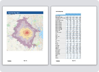
  3. Report Customization: Do you need a specific list of demographics in your reports? Do you need to list the ZIP Codes in each of your areas? The new Report Settings ensure you can see the data that are critical to your analysis.
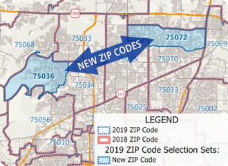
  4. Software and Data: Maptitude 2019 ships with the most up-to-date geographic and demographic information available.

There are many more improvements in Maptitude 2019! Please contact the Maptitude Sales Team with any questions.

Simple file management
Maptitude report customization
Data linking and updating
Maptitude 2019 includes the most up-to-date data

About Caliper

Caliper Corporation develops state-of-the-art Geographic Information Systems (GIS) software. With a focus on usability, Maptitude is designed to be a cost-effective, professionalmapping software product. Maptitude enables organizations to leverage their location-based data to improve decision making and planning, while minimizing expenditure through competitively priced solutions.

Caliper is a privately held corporation and is a leading developer of mapping, redistricting, transportation, and GIS software.

Filed Under: Business Tagged With: caliper, Maptitude

Editor’s Picks

JavaScript: Best Practice

JavaScript: Best Practices

USGS Lidar Base Specification Version 1.2

Boulder County Launches New Geospatial Open Data Platform

Visual Intelligence Wins Grand Award and Technology Innovation Award

See More Editor's Picks...

About Editor

Glenn is a geographer and a GIS professional with over 20 years experience in the industry. He's the co-founder of GISuser and several other technology web publications.

Recent Industry News

How Enterprises Are Using AI to Automate 80% of Customer Interactions With Voice Agents

June 16, 2026 By GISuser

Why On Cloud Shoes Are Worth the Price in Mexico

June 16, 2026 By GISuser

Jinghong vs XAG Agricultural Drones: A Comprehensive Comparison Guide

June 16, 2026 By GISuser

Why Adults Are Trimming Their Routines for Travel and Busy Weeks

June 10, 2026 By GISuser

Hot News

State of Data Science Report – AI and Open Source at Work

HERE and AWS Collaborate on New HERE AI Mapping Solutions

Virtual Surveyor Adds Productivity Tools to Mid-Level Smart Drone Surveying Software Plan

Categories

Copyright gletham Communications 2015 - 2026

Go to mobile version