Singapore, October 11th, 2018. Orbit GT and the Singapore Land Authority (SLA) signed a strategic and comprehensive deal at the Belgian Ambassador’s residence in Singapore.
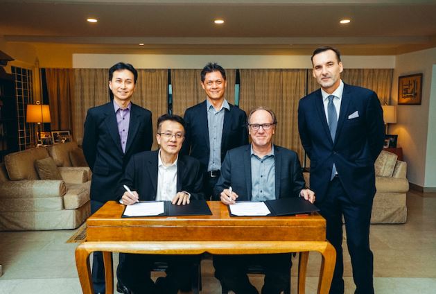
Signature of the agreement at the Ambassador’s office in Singapore. Left to right : Mr. Bryan Chew, Mr. Soh Kheng Peng, Mr. Gerry Ong, Mr. Peter Bonne, H.E. Andy Detaille.
“Orbit GT is honored to be chosen by the Singapore Land Authority (SLA) to provide the Singapore’s Whole of Government (WoG) with 3D Mapping software solutions”, says Peter Bonne, CEO of Orbit GT. “Our gratitude goes to the leading visionaries at the Singapore Land Authority and our Orbit GT local partner GPS Lands.”
This comprehensive deal will allow SLA to access a large amount 3D Mapping content in a click. Served using Orbit GT’s 3D Mapping Cloud, imagery and point cloud data, as well as other 3D content will become available for Singapore’s agencies to view, share, process, extract, operate and integrate 3D mapping data.
Quote by the Ambassador of the Kingdom of Belgium, H.E. Andy Detaille:
“The expression ‘win-win situation’ is much bandied around and much abused these days but, nevertheless, I think it is a perfect fit for the SLA – Orbit GT co-operation where SLA on the one hand can work with the best software on the market and Orbit GT gains a world-class customer in the field of smart cities.”
Quote by FIT (Flanders Investment and Trade) by Ralph Moreau, high representant of Flanders region in Belgium:
“I’m happy to learn Orbit GT, one of our up-and-coming Flemish technology companies, concluded a deal with Singapore’s SLA. SLA – one of the world’s most innovative and progressive land authorities, in charge of optimizing the land resources in Singapore. Today’s contract signing confirms once again there is indeed a demand for our tech companies, delivering targeted and value added solutions to customers. I congratulate Orbit GT with their technological and commercial achievement, and wish both parties success in the roll-out of the project!”
About Singapore Land Authority
The Singapore Land Authority (SLA) is a statutory board under the Ministry of Law whose primary role is to optimise land resources for the economic and social development catering for a wide range of activities of Singapore.
One of SLA’s key role is also in leading and developing geospatial data infrastructure and policies, enabling knowledge and value creation for the Government, enterprise and community. SLA also nurture an environment where best practices and ideas on land and resource administration and management are generated and adopted.
For more details, visit https://www.sla.gov.sg/About-SLA#.W72hpXszZpo
About Orbit GeoSpatial Technologies
Orbit GT is synonymous to Smart 3D Mapping, for Mobile Mapping, UAS Mapping, Indoor Mapping, Aerial Oblique Mapping, and Terrestrial scanning, replacing the big data dilemma with ease of use. Orbit GT is world leader in solutions and expertise for use of 3D Mapping content in managing, viewing, extracting, operating, publishing, sharing and embedding solutions in in workflows, either desktop, on premise and cloud based. Orbit GT is headquartered in Lokeren, Belgium, and enjoys a global business network.
Reality Capture is fast moving to an integrated experience, fusing massive data from various collection techniques such as Mobile Mapping, UAS Mapping, Aerial LiDAR and Oblique Mapping, Indoor and Terrestrial scanning. Orbit GT provides native and real-time fusion, optimized storage and maximum performance on its desktop and online portfolio.
For more information, please contact
Mr. Peter Bonne
Orbit GeoSpatial Technologies NV
Industriepark E17, 2021
9160 Lokeren
Belgium
Phone +32 9 340 5757
Fax +32 9 340 5750
www.orbitgt.com