Geographic Technologies Group (GTG) recently worked with Bozeman to improve their land records GIS platform. The City has a progressive and experienced GIS team.
|
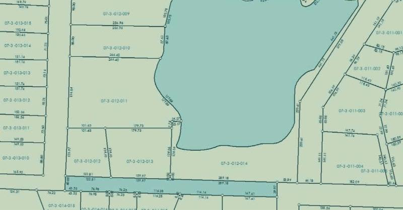
They have built numerous datasets and provide services to the entire City. The initial focus of the GIS project was the compilation of data layers to include tax parcels. The City of Bozeman had approximately 25,000 parcels. Traditional editing tools have been utilized to maintain the parcel layer over the past decade; however, the City has been looking for ways to more systematically manage the parcel layer. After a competitive RFP, the City selected GTG to migrate their existing parcel data to the Esri Parcel fabric and provide on-site training. The Esri Parcel Fabric stores parcel data in a continuous surface of connected parcels ensuring that the relationships between polygons, lines and points are maintained. Using this seamless dataset, Bozeman will be able to effectively store and manage all of its land records data including parcels and easements. Jon Henderson, GIS Manager for the City of Bozeman points out, “We are always looking for ways to advance GIS for the City. The tools continue to evolve. We want to take every advantage of the new innovations in GIS to include parcel management.”
|
 |
|
|
|
GTG developed a data migration plan with the City, starting by conducting a workshop with city staff to modify the Parcel Fabric for the specific needs of Bozeman. Once the workshop was complete, GTG performed the migration, reconciling Historic, Zoning and Lighting District boundary data layers, and modeling city boundaries and property annexations. ArcGIS Data Reviewer was used once the parcel data was loaded, and a Data Migration Standard Operating Procedures document was created for staff’s future use. Training on editing and administering the Parcel Fabric data was provided for city staff once the migration was complete. Curt Hinton, President of GTG, highlighted the following: “Bozeman is a leader in GIS for the State of Montana. They understand that GIS is a primary tool for good governance. The GIS team at Bozeman really is advanced and as such wants to responsibly leverage the best GIS has to offer. The project culminated with an on-site Gap Analysis workshop that was invigorating as we identified many opportunities for continued growth and adoption of GIS at the City.”
|
|
For more information about the Esri Parcel Fabric, contact David Lyons at www.gtg.com
|