GIS user technology news

News, Business, AI, Technology, IOS, Android, Google, Mobile, GIS, Crypto Currency, Economics

  • Advertising & Sponsored Posts
    • Advertising & Sponsored Posts
    • Submit Press
  • PRESS
    • Submit PR
    • Top Press
    • Business
    • Software
    • Hardware
    • UAV News
    • Mobile Technology
  • FEATURES
    • Around the Web
    • Social Media Features
    • EXPERTS & Guests
    • Tips
    • Infographics
  • Blog
  • Events
  • Shop
  • Tradepubs
  • CAREERS
You are here: Home / * PRESS / Earth Imaging - Remote Sensing / EarthServer Projekt goes into the second round

EarthServer Projekt goes into the second round

July 17, 2015 By GISuser

The EarthServer initiative is establishing Agile Analytics on Petabyte data cubes as a commodity.
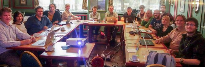
EarthServer-2 kickoff meeting on May 22, 2015 in Munich

EarthServer-2 kickoff meeting on May 22, 2015 in Munich

Pushing the boundaries of Big Earth Data services, the intercontinental Earthserver initiative enables researchers to browse, access, and analyze massive multi-dimensional data sets from a wide range of sources. Big Earth Data at your fingertips – this is the vision of EarthServer for unleashing the potential of Big Data through a disruptive paradigm shift in technology: 

• from isolat-ed silos of data with disparate functionality towards a single, uniform information space; 
• from a difficult, artificial differentiation between data and metadata access to unified retrieval; 
• from zillions of files towards few whatever-size datacubes; 
• from limited functionality to the freedom of asking anything, anytime, any server in a peer network of data centers worldwide. 

In phase 1, EarthServer has established open ad-hoc analytics on massive Earth Science data, based on and extending the leading Array Database technology, rasdaman. According to EU Commission and inde pendent reviewers, rasdaman will “significantly transform the way that scientists in different areas of Earth Science will be able to access and use data in a way that hitherto was not possible” as demonstrated by portals with over 230 TB of spatio-temporal data. EarthServer “with no doubt has been shaping the Big Earth Data landscape through the standardization activities within OGC, ISO and beyond”. 

Now phase 2 of EarthServer has started, with an even more ambitious goal: data centers will provide at least 1 Petabyte of 3-D and 4-D datacubes. Technology advance will allow real-time scaling of such Petabyte cubes, and intercontinental fusion. This power of data handling will be wrapped into direct visual interaction based on multi-dimensional visualization techniques, in particular: NASA World Wind. Following the motto “a cube says more than a million images” EarthServer has set out to redefine the Big Data service landscape even more. 

This way, critical support will be given to Copernicus and the Sentinel satellite data: a single 3D x/y/t datacube will be constructed for each satellite instrument so that millions of images form a single, simple data space, irrespective of its size resulting. Likewise, each climate dataset will form a single 4D datacube. Access to these cubes is through a clean-slate standards-based query language on n-D grids, OGC WCPS. This yields the agility that any query can be sent at any time, without admin intervention on server side. Multiple cubes can be combined based on parallel, distributed processing. Altogether, the WCPS language allows navigation, extraction, aggregation, and fusion of any-size space/time data cubes using simple, yet powerful query operators. 

The consortium consists of Jacobs University (Germany, coordinator), rasdaman GmbH (Germany, SME), , Plymouth Marine Laboratory (UK), European Center for Medium-Range Weather Forecasts (UK), MEEO s.r.l. (Italy, SME), and CITE S.A. (Greece, SME). Additionally, two high-profile international organizations participate: NASA (US) and National Computational Infrastructure (Australia). 

Read more: www.earthserver.eu

Filed Under: Earth Imaging - Remote Sensing Tagged With: EarthServer initiative

Top Press

The Global Expansion of Aueshah: A New Era of High Jewelry

April 11, 2026 By GISuser

KARACHI, PAKISTAN. The international luxury market is experiencing a profound shift. Consumers are increasingly rejecting mass-produced goods in favor of rarity, authenticity, and emotional depth. … [Read More...]

State of Data Science Report – AI and Open Source at Work

September 10, 2025 By GISuser

AI and Open Source at Work … [Read More...]

Topcon Announces Landmark Expansion of Topnet Live Network Across USA

January 26, 2025 By GISuser

LIVERMORE, Calif.---Topcon Positioning Systems has announced a significant expansion of its Topnet Live reference station network, introducing 200 new geodetic stations strategically positioned across … [Read More...]

Space Flight Laboratory (SFL) Announces Launch and Deployment of NorSat-4 Maritime Monitoring Microsatellite

January 19, 2025 By GISuser

Seventh Satellite Developed by SFL for Norway … [Read More...]

HERE and BMW Group extend partnership on AI-powered mapping system

January 8, 2025 By GISuser

HERE and BMW Group extend partnership on AI-powered mapping system for automated driving and enhanced road safety … [Read More...]

Everest Base Camp Helicopter Tour, Helicopter Return Trek, and Manaslu Circuit Trek: Which Nepal Adventure Is Right for You?

November 6, 2026 By GISuser

Almost everyone planning a Nepal trip runs into the same wall. You want the big mountains, you have a fixed number of days, and every itinerary you read seems to promise something … [Read More...]

SFL Missions Inc. Confirms Successful Deployment of Six HawkEye 360 Radio Frequency Detection Satellites with Advanced Capabilities

October 27, 2026 By GISuser

MĀHIA, New Zealand, 26 October 2026 – SFL Missions Inc. today confirmed the successful deployment of six radio frequency (RF) detection and geolocation satellites for HawkEye 360 … [Read More...]

Canadian-Built RoadEng 12 Uses AI to Find the Best Location for New Resource and Rural Roads

October 17, 2026 By GISuser

Vancouver, BC, Canada, October 15, 2026 – North Vancouver-based Softree Technical Systems today released RoadEng Version 12, used in more than 75 countries to locate and design … [Read More...]

Beyond the Map: How AI Image and Video Generation Is Changing Geospatial Communication

October 14, 2026 By GISuser

Ask anyone who has shipped a GIS project what the hardest part was, and the answer is rarely the spatial analysis. It is almost always the communication. A site suitability … [Read More...]

From Maternity to Everyday Wear: Building a Wardrobe That Grows With You

October 14, 2026 By GISuser

When I think about maternity clothing, I feel the biggest mistake is buying too many things at once. During pregnancy, your body keeps changing, and something that fits well today … [Read More...]

Copyright gletham Communications 2015 - 2026

Go to mobile version