GIS user technology news

News, Business, AI, Technology, IOS, Android, Google, Mobile, GIS, Crypto Currency, Economics

  • Advertising & Sponsored Posts
    • Advertising & Sponsored Posts
    • Submit Press
  • PRESS
    • Submit PR
    • Top Press
    • Business
    • Software
    • Hardware
    • UAV News
    • Mobile Technology
  • FEATURES
    • Around the Web
    • Social Media Features
    • EXPERTS & Guests
    • Tips
    • Infographics
  • Blog
  • Events
  • Shop
  • Tradepubs
  • CAREERS
You are here: Home / * PRESS / Environment / Oklahoma Forestry Services Wildfire Collector: There’s an App for That

Oklahoma Forestry Services Wildfire Collector: There’s an App for That

April 2, 2015 By GISuser

The Collector app is being called a game changer by Oklahoma Forestry Services (OFS) as it becomes the first state agency in the nation to utilize it for wildfire initial attack. This new, cutting-edge app enhances fire situational awareness by pulling all of the information and tools needed to fight wildfires into one program. Collector, developed by Esri, a company which specializes in information management, provides critical information quickly, resulting in faster fire suppression, and increased safety for the public and firefighters.
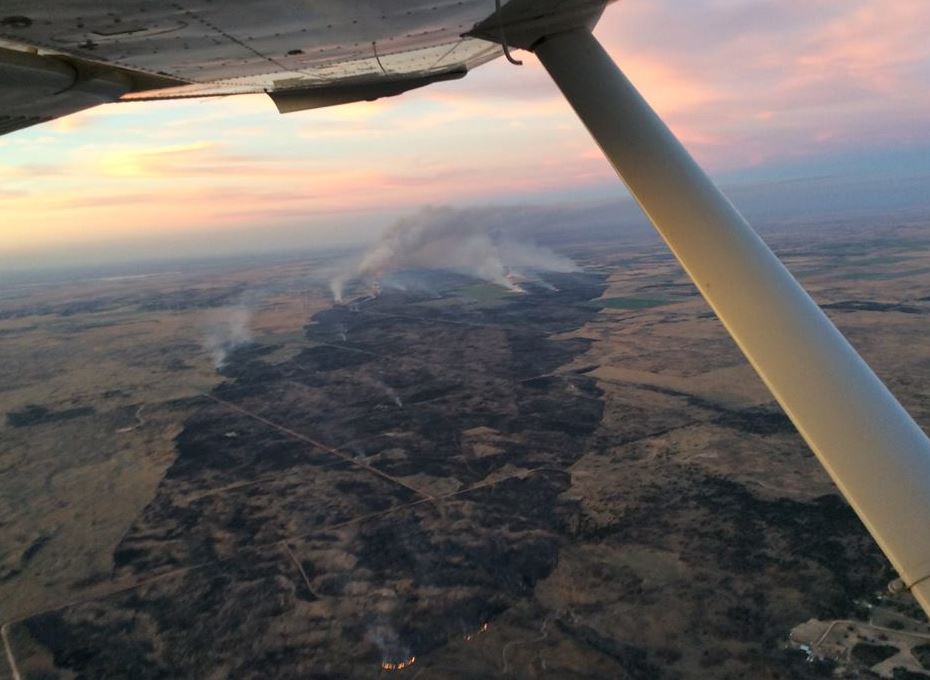
Wildfire: There’s an App for That

Wildfire: There’s an App for That

“There have been other products out there that gave us some information, but none that provided nearly instantaneous, real-time transfer of information until Collector,” said Mark Goeller, fire management chief, Oklahoma Forestry Services. ”It means that fires can be more quickly sized up and firefighters efficiently deployed to the areas where they are most needed.”

Arriving on the scene of a large wildfire incident, firefighters must quickly assess the situation, devise a strategy and develop tactics to convey to the other responders. Collector facilitates the process, allowing for accurate and timely analysis including fire perimeter, vital incident information and incident progress for all responders to receive real-time on their mobile devices.

In addition to seeing the fire size and location on their devices, the firefighters can also:

·       View structures, roads and terrain

·       Measure land by distance and area, including affected acreage

·       Type in an address or GPS location and get directions and maps

·       Attach, view and edit photos and documents

·       Download maps and work offline

·       Track and report incident progress

“The Guthrie fire in May 2014 provides a good example of how utilizing the Collector app saved time and prevented the loss of additional homes and structures,” said Goeller. “We utilized the app in an Oklahoma Highway Patrol aircraft and communicated fire behavior and difficult access to ground crews, enabling them to halt the fire spread well before reaching additional structures.

Before Collector, this type of aerial intelligence was conveyed through radio communication, visually directing crews to specific areas using landmarks that could be seen from the aircraft.”

The OFS observer in the aircraft used Collector on an iPad to draw a needed fire line on the map, which was communicated in near real time on the iPad map held by ground personnel. The ground firefighters were able to quickly see their location and where they need to go. By utilizing the Collector app, it is estimated that in this instance firefighters began firefighting at least an hour sooner than without the technology.

Oklahoma Forestry Services is the state’s lead agency for fighting wildland fire. The agency has successfully utilized the Collector app on numerous wildland fires in the past year, introducing the app to firefighters, Oklahoma Highway Patrol pilots and other fire professionals in the process. It is in the initial stages of rolling it out to county wildland task forces and fire departments across the state.

About Oklahoma Forestry Services

Oklahoma Forestry Services, a division of the Oklahoma Department of Agriculture, Food and Forestry, is committed to conserving, enhancing and protecting Oklahoma’s 12.5 million acres of forests and woodlands. Since 1925, Oklahoma Forestry Services has worked with individuals and communities throughout the state to create resilient landscapes, fire-adaptive communities and provide wildfire response. Headquartered in Oklahoma City, the division also has regional offices in Goldsby, Broken Bow, Wilburton and Tahlequah. For more information, visit http://www.forestry.ok.gov.

[Tweet “Wildfire: There’s an App for That”]

Filed Under: Environment, Government & OpenGov, Mobile, Top Press Tagged With: collector, ESRI, mobile app, wildfire

Top Press

The Global Expansion of Aueshah: A New Era of High Jewelry

April 11, 2026 By GISuser

KARACHI, PAKISTAN. The international luxury market is experiencing a profound shift. Consumers are increasingly rejecting mass-produced goods in favor of rarity, authenticity, and emotional depth. … [Read More...]

State of Data Science Report – AI and Open Source at Work

September 10, 2025 By GISuser

AI and Open Source at Work … [Read More...]

Topcon Announces Landmark Expansion of Topnet Live Network Across USA

January 26, 2025 By GISuser

LIVERMORE, Calif.---Topcon Positioning Systems has announced a significant expansion of its Topnet Live reference station network, introducing 200 new geodetic stations strategically positioned across … [Read More...]

Space Flight Laboratory (SFL) Announces Launch and Deployment of NorSat-4 Maritime Monitoring Microsatellite

January 19, 2025 By GISuser

Seventh Satellite Developed by SFL for Norway … [Read More...]

HERE and BMW Group extend partnership on AI-powered mapping system

January 8, 2025 By GISuser

HERE and BMW Group extend partnership on AI-powered mapping system for automated driving and enhanced road safety … [Read More...]

Everest Base Camp Helicopter Tour, Helicopter Return Trek, and Manaslu Circuit Trek: Which Nepal Adventure Is Right for You?

November 6, 2026 By GISuser

Almost everyone planning a Nepal trip runs into the same wall. You want the big mountains, you have a fixed number of days, and every itinerary you read seems to promise something … [Read More...]

SFL Missions Inc. Confirms Successful Deployment of Six HawkEye 360 Radio Frequency Detection Satellites with Advanced Capabilities

October 27, 2026 By GISuser

MĀHIA, New Zealand, 26 October 2026 – SFL Missions Inc. today confirmed the successful deployment of six radio frequency (RF) detection and geolocation satellites for HawkEye 360 … [Read More...]

Canadian-Built RoadEng 12 Uses AI to Find the Best Location for New Resource and Rural Roads

October 17, 2026 By GISuser

Vancouver, BC, Canada, October 15, 2026 – North Vancouver-based Softree Technical Systems today released RoadEng Version 12, used in more than 75 countries to locate and design … [Read More...]

Beyond the Map: How AI Image and Video Generation Is Changing Geospatial Communication

October 14, 2026 By GISuser

Ask anyone who has shipped a GIS project what the hardest part was, and the answer is rarely the spatial analysis. It is almost always the communication. A site suitability … [Read More...]

From Maternity to Everyday Wear: Building a Wardrobe That Grows With You

October 14, 2026 By GISuser

When I think about maternity clothing, I feel the biggest mistake is buying too many things at once. During pregnancy, your body keeps changing, and something that fits well today … [Read More...]

Copyright gletham Communications 2015 - 2026

Go to mobile version