In the wake of the tragedy that has struck Haiti, Global imagery provider, GeoEye has captured, processed and made available AFTER Earthquake Satellite image of Port-au-Prince, Haiti.
From GeoEye:
Below is a portion of imagery from an ftp site that contains an "AFTER THE QUAKE" satellite image (jpg and tiff files) of Port-au-Prince taken by our GeoEye-1 satellite from 423 miles in space at 10:27 am EST on Jan. 13, 2010 as it moved from north to south over the Caribbean at a speed of 4 miles per second. Ground resolution is half meter (19 inches).
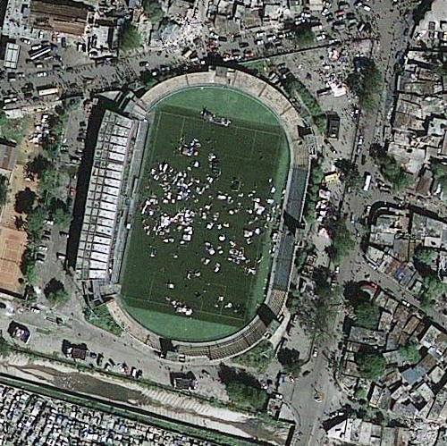
The imagery clearly shows extensive damage throughout the city. One can see roads covered with debris from collapsed structures, people crowded in the streets and in open public places such as sports fields and stadiums. Many buildings appear to be flattened. photo credit: "GeoEye Satellite Image"
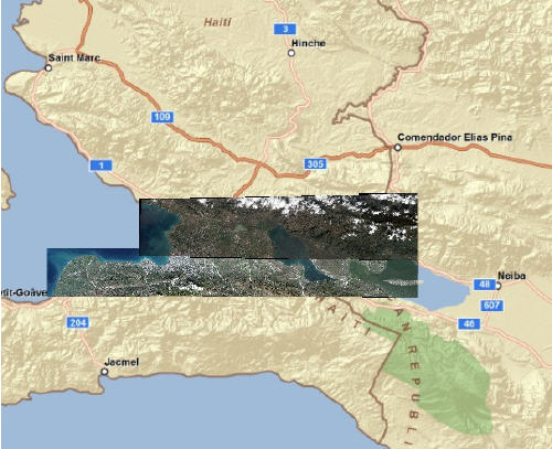
Image coverage area, Haiti – photo credit: "GeoEye Satellite Image"
More info at Geoeye.com
Related Twitter Comments
Related Articles:
- Four GISCorps volunteers are needed for a Haiti mission
- The Haiti imagery layer from Google for Google Earth
- OSM Route Service Online for Haiti supporting disaster management after the earthquake
- NGA Supports Haiti Earthquake Recovery Efforts
- DigitalGlobe – Free access to Haiti imagery pre- and post-earthquake
- Haiti Geo Resource – FortiusOne Mapping Haiti Quake Effects and Relief Efforts
- GeoEye Makes Available AFTER Earthquake Satellite image of Port-au-Prince, Haiti
- ESRI Flex Map Viewer Shows Haiti Earthquake Locations
-
Geo Tech Companies Support Recovery efforts in Haiti