Clint Brown is a name you will recognize and a familiar face to anyone who’s ever attended an International ESRI UC. He should, Clint is the Director of Software Products Esri, Inc. and will no doubt, once again, be a familiar presence on stage at the UC.
 Clint has always been eager to share with us, for example, almost every year he shares his favorite 10 UC things to do, he also provides feature content occasionally, like this fine article (still very interesting) back in 2004 titled "The Role of GIS Portals and Spatial Data Infrastructures" Several times over the years we’ve asked Clint if he’d like to share a few pointers and tips highlighting interesting things that people should have on their "Must Do" list while attending this year’s conference. And so… once again we’re pleased to share 10 things to do at the Esri User Conference in 2010
1. Attend the Monday morning plenary.
Each year, Jack and other ESRI staff will present our vision for where GIS is headed. Jack has a rare ability to get a clear message across to around ten thousand people in one huge room and to help us all understand where we are headed. In our conference preparations here over this past month, we have come to realize that the GIS community is at the dawn of a whole new era, which will build on your collective work (from the world’s 300,000 GIS organizations). Come to the plenary to have your sites adjusted.
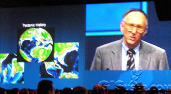
Write down some of Jack’s ideas and visions, store them in an envelope, and pull out of the envelope in five or so years.
2. Catch the Monday afternoon keynote with Richard Saul Wurman.
This is the man. He has written so many great books that I’ve lost count (several times). He is smart, funny outspoken, novel, and frank. He has fun about serious subjects. He is one of the most creative, original people you’ll ever meet. He works very hard at encouraging humans to get connected and to communicate. He wants people to understand their local communities, and has a very interesting message for the GIS community. His talk will be one of the highlights of a week filled with highlights.
3. The Map Gallery and Monday Evening Reception.
This is a rich exhibit with many special events and maps from over 1,500 organizations all on display. Come learn how your work is part of a collective effort globally and how as a community we contribute. You can also learn some new tips and tricks from your peers.
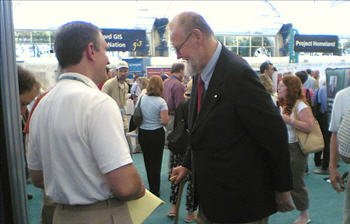
Roger Tomlinson walking through the map gallery
4. Lightning Talks.
If you’ve got something useful to say, we’re all ears. But, you only get 5 minutes. Watch people blast through some amazing presentations and see if they can "beat the gong." The lightning talks are fun, fast, interesting, and dynamic.
5. Technical workshops.
ArcGIS 10 is finished. This new online version of ArcGIS is just beginning to ship and will change the perspective for how we use, apply, and experience GIS. There are well over 100 technical workshops that you can use to learn about all aspects of Version 10 and about many other aspects of GIS. These are presented by ESRI technical staff from the development teams at ESRI. It’s a great chance for you to get connected with people who work for you.
6. User presentations.
Users present a broad range of topics on their GIS implementations. These cover many disciplines and domains – from industry, government, science, conservation organizations, and many more. These user presentations are entertaining as well as enlightening. It is very fun and inspirational to hear how a user accomplished some very interesting work. The insights you’ll gain from their experiences are worth a lot. They will help you be more successful in your GIS endeavors.
7. Engaging and sharing among users.
When is the last time you made eye contact with a stranger? It’ll happen at the user conference. One of the rare aspects of this meeting is how attendees engage with one another – even the shy people. GIS users are a rare breed – they actually connect with and communicate with one another – to learn and share, to teach, to discuss and debate, and to have fun. Reach out at the conference and meet someone new. You have something to important and enlightening to share and so do they.
You can learn a lot from the people you’ll meet. Some of the brightest and most impressive people in the GIS community from the four corners of the world are always in attendance. You can hear their presentations and learn from them, meet them, dig deeper into various aspects of their work. A key highlight for every user is what you teach one another.
8. Vendor exhibits.
Lots of impressive business partners, flash, and bang. Great people, some of whom give things away that you can take home to your kids. It’s like Halloween for grownups. Plus, you can find a solution to your problem. Not bad for such a fun and entertaining showcase.
9. San Diego.
There is plenty to do in San Diego. Make sure to slip out before, during, or after the user conference. Rupert Essinger from ESRI has published a nice map tour of San Diego using ArcGIS Explorer Online. Check it out for other great ideas, or add your own favorites and share your map.
Go to the Zoo, Old Town, golfing, spot marine life at Point Loma or La Jolla, or go bird-watching. Take the short little taxi boat ride across the bay to Coronado Island.

10. Seeing old friends and making new ones.
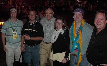
For me, personally, seeing old friends is very important. I started coming to the conference in 1983 where, after the 2-day conference, about a dozen of us attended the first training class for ArcInfo 1.0. I still see my friends from back then and others that I have met through the years. Friends mean a lot in a sea of thousands.
Other useful articles from previous ESRI UC’s:
- Clint Brown Shares 10 Cool Things about the 2007 ESRI User Conference
- Ten Things You Will Not Want To Miss at The ESRI UC This Year
- ESRI User Conference 2005 – Highlights for the 25th ESRI User Conference from Clint
- ESRI User Conference 2004 – Highlights for the 2004 UC from Clint Brown
- Ten Things You Will Not Want To Miss at The ESRI UC This Year
- GISuser Conference Notes – ArcGIS 9.0, ArcGIS Server, extensions and the road ahead
- ESRI UC Report – Intro from Jack Dangermond & Moving Towards ArcGIS 9.2
- Preparing for the 2004 ESRI UC
- Preparing For the 2005 International ESRI UC
- Preparing For the 2006 (26th) International ESRI User Conference
- San Diego –
ESRI UC 2004 – PHOTOS - more photos from 04′
- San Diego –
ESRI UC 2005 – PHOTOS - San Diego –
ESRI UC 2006 – PHOTOS - http://www.sandiego.org/
ESRI’s Clint Brown talks about bringing Geographic Information to life and gives a preview of his session at the 2009 ESRI UC
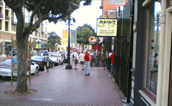
A tip, if all else fails and you want to have a beer with a few new ESRIUC friends, just drop in to Dick’s some night… you can’t miss!