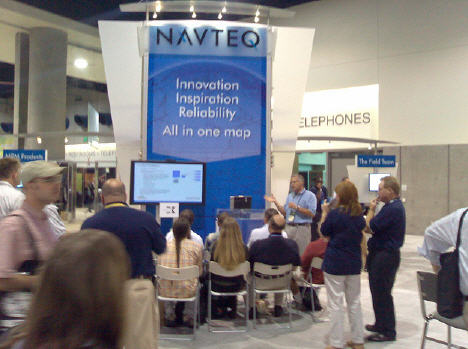
 NAVTEQ has exhibited at the ESRI International User Conference for the past six years, and the 2010 event marks NAVTEQ’s fourth year as a Gold Level sponsor.
This year’s event will take place July 12-16, 2010, in San Diego, California. NAVTEQ will host a variety of activities during the conference showcasing how ESRI software with NAVTEQ data can benefit GIS users.
ESRI and NAVTEQ have a strong business relationship, collaborating on the delivery of high-value GIS and navigation solutions. NAVTEQr map data, combined with ESRI software, meets the spatial analysis needs of developers and solution providers across a wide variety of enterprise and consumer applications. NAVTEQ, an ESRI Corporate Alliance Partner, works closely with ESRI to produce end-to-end solutions with the customer in mind.
NAVTEQ can be integrated into a wide range of ESRI software and services:
- Desktop GIS-ArcView, ArcEditor, ArcInfor, ArcGIS Extensions
- Server GIS-ArcGIS Server, Tracking Server
- Developer GIS-ESRI Developer Network, ArcGIS Engine
- Mobile GIS-ArcPadr, Mobile ArcGIS Desktop Systems
- Web GIS-ArcGIS Online
- Business GIS-ArcGIS Business Analyst
- Navigation-ArcLogisticsr and ArcLogistics Navigator
In the booth this year, NAVTEQ will feature demonstrations by industry professionals on topics in each of the following verticals: Utilities, Transportation, Government, and Insurance. Demonstrating partners include:
BroadMap displaying MapConnectT Enterprise for GIS and Government
MapConnect Enterprise is a user-friendly GIS platform for enterprise solutions based on industry-leading NAVTEQ data for the U.S. This product enables rich map display, superior geocoding, and basic routing functionality for a wide variety of business, non-profit and government users. The unique data format of MapConnect Enterprise has been designed specifically for ease of use and out-of the-box simplicity. This solution represents a new product offering in the delivery of enterprise geospatial data that is solely focused on the enterprise GIS market across government and commercial users; addresses their need to migrate from discontinued enterprise data solutions
RAMTeCH Technologies, Inc. displaying gMaintenance for Utilities
gMaintenance is a software solution that enables clients to reconcile and synchronize changes and updates from new releases of NAVTEQ map data with their internal land base and data maintenance activities that occurr between NAVTEQ releases. Features include and support a "feedback loop" with NAVTEQ. The gMaintenance software is built using ESRI technology and supports ESRI clients’ needs within the Utilities, Telecommunications and Government space.
RouteSmart Technologies, Inc. displaying RouteSmart for ArcGIS for Utilities
RouteSmart for ArcGIS is an advanced, ESRI-based application used by utilities to streamline their field service logistics. Application areas within utilities include meter reading, turn-on/turn-off service, cycle day balancing, and mis-read routing. RouteSmart for ArcGIS is based on ESRI technology.
Trimble Navigation LTD displaying Yuma – a ruggedized device for Transportation
The Trimble Yuma tablet is an integral part of the Trimble family of mapping and GIS solutions, compatible with a full range of professional GIS data collection and utilities field solutions software, including Trimble Fieldportr and UtilityCenterr software for GIS mapping and redlining, asset maintenance, mobile workforce management, and outage response. Users can easily integrate the Trimble Yuma tablet into your current workflows, alongside your other Trimble field equipment. Supported by ESRI ArcGIS and NAVTEQr map data, the Yuma device enables a unique solution for transportation needs.
NAVTEQ will be giving away one Garmin nuvi 205 portable navigation devices each day to a lucky person chosen at random from persons who register at the NAVTEQ booth. Be sure to take advantage of this opportunity to learn how other organizations are using NAVTEQ data in ESRI applications.
NAVTEQ is a proud sponsor of various ESRI events that will be taking place during the ESRI international User Conference. Below is a list of key events where you can find NAVTEQ:
ESRI Federal Reception:
Date: Tuesday, July 13, 2010
Time: 6:30 pm-9:30 pm
Location: Sapphire Terrace of the Hilton San Diego Bayfront.
Please RSVP for the Federal Reception.
ESRI Transportation SIG:
Date: Sunday-Thursday, July 11-15, 2010
ESRI Homeland Security GIS Summit Sponsorship
Date: Saturday, July 10, 2010 – July 13, 2010
Time: 4:00 PM – 7:00 PM (Expo)
Booth #113
Lunch Sponsor
Social Sponsor
ESRI Business GIS Summit Sponsorship
Date: Sunday, July 11, 2010
Times: 5:00 PM – 7:30 PM
Booth #7
ESRI Defense & Intelligence ShowcaseSponsorship
Date: Sunday, July 12 – 15, 2010
Time: TBD
Booth #343
ESRI Latin America Regional User Group
Date: Tuesday, July 13
Time: 5:00 PM – 7:00 PM
Visit www.navteq-connections.com/enterpriseamericas/events for more information.
Related news, weblinks, & articles:
- Liverpool Unveils NAVTEQ’s Interactive GPS Zones Featuring Premium Brand PNDs
- NAVTEQ(R) Map To Power Mobile Devices’ Telematics Platforms and Connected PNDs
- NAVTEQ Expands Agreement With National Geospatial-Intelligence Agency (NGA)
- NAVTEQ Reminds Consumers of the Importance of GPS Map Updates During the Summer Driving Season
- NAVTEQ Focuses on Transport and Logistics Solutions at the National Private Trucking Council Event