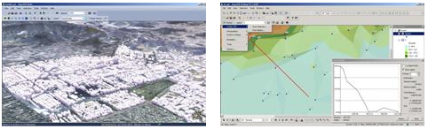
SuperGIS 3D Analyst 3.0 which works on SuperGIS Desktop 3.1 has been officially launched worldwide.
SuperGIS 3D Analyst 3.0 is an extension which provides 3D visualization and surface analysis method, enabling users to input image, vector or elevation data to analyze surface change, query information or calculate visible range of the specific point on the surface. Furthermore, by utilizing SuperGIS 3D Analyst 3.0 to overlay image data, vector data and surface data, users can simulate the real world and display 3D model.
To provide users with complete 3D analysis functions, the newest SuperGIS 3D Analyst 3.0 optimizes analysis functions including the support of triangulated irregular network (TIN), “Generate Contours” and “Generate Steepest Path.” Besides, SuperGIS Globe enhances user interface and provides friendly manipulation environment to assist users in displaying 3D model to recognize surface undulation by fly tool.
SuperGIS 3D Analyst 3.0 which works on SuperGIS Desktop 3.1 has been released. To know more about the related products, please visit SuperGeo website: http://www.supergeotek.com, or contact with us by e-mail: staff@supergeotek.com .