GIS user technology news

News, Business, AI, Technology, IOS, Android, Google, Mobile, GIS, Crypto Currency, Economics

  • Advertising & Sponsored Posts
    • Advertising & Sponsored Posts
    • Submit Press
  • PRESS
    • Submit PR
    • Top Press
    • Business
    • Software
    • Hardware
    • UAV News
    • Mobile Technology
  • FEATURES
    • Around the Web
    • Social Media Features
    • EXPERTS & Guests
    • Tips
    • Infographics
  • Blog
  • Events
  • Shop
  • Tradepubs
  • CAREERS
You are here: Home / News / Local Government GIS / Village Gets Workflow in Line with Cityworks

Village Gets Workflow in Line with Cityworks

February 6, 2014 By Editor

Work Completion Time Cut in Half within Two Weeks using GIS-centric Solution

Sandy, UT – The Village of Pleasant Prairie, Wisconsin, has cut work order completion time in half after two weeks of initial training with Cityworks software, allowing their workflow to fall in line through Cityworks. The village now sees vast improvements in managing their public asset management workflow, and they look forward to continued future benefits with the platform.
 
Pleasant Prairie covers a thirty-six square mile area in the southeast corner of Wisconsin, and Cityworks has been a good fit for their public works crew of twenty-five full-time employees who manage over ten thousand assets. Over the course of a few months, public works supervisors, along with IT personnel, developed a workflow that covers Pleasant Prairie’s needs.

“Cityworks is user friendly, and its integration with ArcGIS puts a wealth of information in the hands of the crews in the field,” states Tom Hupp, manager of technical support at Pleasant Prairie. “The workflow that has been created is very similar to the way it was done on paper before, which allowed for an easier transition for our supervisors and employees. The work order completion time was cut in half in as little as two weeks after the initial training. Adapting a Cityworks workflow was the key to a successful implementation.”
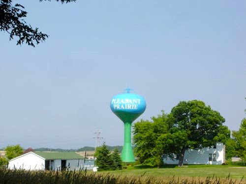
pleasantprairietower 2

Pleasant Prairie’s Public Works Department foremen use laptops connected to large screen televisions to distribute work assignments to the crews in morning meetings. To access Cityworks in the field, the crews use portable tablets equipped with cell cards for accessing the Internet and built-in cameras for attaching pictures to work orders. Assigning work orders to crews gives administrators the flexibility to delegate work orders to multiple employees and manage crews. A mixture of custom observations, service requests, and inspections are used within the work orders to track needed information.

“The customizable nature of Cityworks workflows provides users with powerful tools to adapt the software to their specific needs,” states Brian Haslam, president and CEO of Cityworks. “The example of Pleasant Prairie cutting its work order completion time in half, and very quickly at that, is a reiteration of what we repeatedly see at Cityworks user sites: improved work turnaround time and gained efficiencies. As we discuss Cityworks capabilities, let’s not forget the invaluable role GIS plays in making Cityworks the dynamic, superior solution that it is.”      
 
About Cityworks
Since 1986, Cityworks – Azteca Systems Inc. has provided innovative GIS-centric Asset Management Solutions to organizations that own and care for critical infrastructure, capital assets, and property. Created and designed exclusively on Esri’s ArcGIS technology, Cityworks is a powerful, scalable, and affordable solution for asset management, permitting, licensing, and more. Time-tested, proven, and a leading system, Cityworks is Empowering GIS® at organizations throughout North America and around the world.

Filed Under: Local Government GIS Tagged With: Business, News, Village Gets Workflow in Line with Cityworks

About Editor

Glenn is a geographer and a GIS professional with over 20 years experience in the industry. He's the co-founder of GISuser and several other technology web publications.

Top Press

The Global Expansion of Aueshah: A New Era of High Jewelry

April 11, 2026 By GISuser

KARACHI, PAKISTAN. The international luxury market is experiencing a profound shift. Consumers are increasingly rejecting mass-produced goods in favor of rarity, authenticity, and emotional depth. … [Read More...]

State of Data Science Report – AI and Open Source at Work

September 10, 2025 By GISuser

AI and Open Source at Work … [Read More...]

Topcon Announces Landmark Expansion of Topnet Live Network Across USA

January 26, 2025 By GISuser

LIVERMORE, Calif.---Topcon Positioning Systems has announced a significant expansion of its Topnet Live reference station network, introducing 200 new geodetic stations strategically positioned across … [Read More...]

Space Flight Laboratory (SFL) Announces Launch and Deployment of NorSat-4 Maritime Monitoring Microsatellite

January 19, 2025 By GISuser

Seventh Satellite Developed by SFL for Norway … [Read More...]

HERE and BMW Group extend partnership on AI-powered mapping system

January 8, 2025 By GISuser

HERE and BMW Group extend partnership on AI-powered mapping system for automated driving and enhanced road safety … [Read More...]

Everest Base Camp Helicopter Tour, Helicopter Return Trek, and Manaslu Circuit Trek: Which Nepal Adventure Is Right for You?

November 6, 2026 By GISuser

Almost everyone planning a Nepal trip runs into the same wall. You want the big mountains, you have a fixed number of days, and every itinerary you read seems to promise something … [Read More...]

SFL Missions Inc. Confirms Successful Deployment of Six HawkEye 360 Radio Frequency Detection Satellites with Advanced Capabilities

October 27, 2026 By GISuser

MĀHIA, New Zealand, 26 October 2026 – SFL Missions Inc. today confirmed the successful deployment of six radio frequency (RF) detection and geolocation satellites for HawkEye 360 … [Read More...]

Canadian-Built RoadEng 12 Uses AI to Find the Best Location for New Resource and Rural Roads

October 17, 2026 By GISuser

Vancouver, BC, Canada, October 15, 2026 – North Vancouver-based Softree Technical Systems today released RoadEng Version 12, used in more than 75 countries to locate and design … [Read More...]

Beyond the Map: How AI Image and Video Generation Is Changing Geospatial Communication

October 14, 2026 By GISuser

Ask anyone who has shipped a GIS project what the hardest part was, and the answer is rarely the spatial analysis. It is almost always the communication. A site suitability … [Read More...]

From Maternity to Everyday Wear: Building a Wardrobe That Grows With You

October 14, 2026 By GISuser

When I think about maternity clothing, I feel the biggest mistake is buying too many things at once. During pregnancy, your body keeps changing, and something that fits well today … [Read More...]

Copyright gletham Communications 2015 - 2026

Go to mobile version