Visual Intelligence Releases iOne Sensor Reconfiguration Kit for the iOne Stereo, n-Oblique/3D and IMS Geoimaging Sensor Systems Solutions – Flexible, Scalable iOne Solutions Can Now Be Reconfigured in the Field—Providing Three Sensors for Less than the Price of One Traditional, Monolithic Digital Airborne Camera
“This sensor reconfiguration kit is particularly valuable to small geoimaging companies, which represent a sizable segment of the geospatial market. With traditional, monolithic cameras, these companies would need to make a huge investment in multiple products and would have a daily struggle switching equipment between jobs to match each project. The iOne SRK gives companies the flexibility to adapt their affordable, multi-purpose iOne sensor system to the needs of a wide range of projects. It can quickly, easily be converted in the field from large format to very large format to oblique/3D and back again,” said Visual Intelligence President and CEO Dr. Armando Guevara.
A direct outgrowth of the iOne STKA, which won the 2013 Geospatial Forum World Technology Innovation in Sensors Award , the iOne SRK allows the iOne Sensor System Family to be field reconfigured from stereo large area collection to oblique/3D and from just color to multispectral. It can also be CoCo® (co mounted and co –registered) with other passive (e.g. thermal) or active (e.g. LiDAR) sensors.
Guevara added: “Single-purpose aerial cameras prove to be a very expensive solution when geoimaging companies need to adapt to the larger collection requirements or the oblique/3D requirements of various projects. The bottom line is that monolithic cameras are inflexible and cost too much. iOne sensor systems change all of that by providing dramatically more flexibility, much higher quality and substantially higher performance—all for less of a customer’s budget. As such, I invite any company that is looking to buy a new medium format, large format, or oblique/3D digital airborne camera to take one of our sensor systems for a test drive and discover how the iOne Sensor System innovation can radically improve their bottom line. A large portion of the large format sensor systems that are currently in use by geoimaging companies are reaching the end of their product life either because of obsolescence or performance issues. Any company that is in the market to replace that equipment should look closely at iOne before making a final decision because the technical and financial advantages are so significant.”
With the iOne SRK, our users are able to have a multipurpose sensor solutions. Following are just a few of the features and benefits of the iOne SRK:
- Provides the most flexible large-format solution in the geoimaging market by allowing the iOne Stereo to be scalable from 12kps to 19kps (large to very large area collection).
- Allows the iOne Stereo to be reconfigurable into the iOne n-Oblique, which is the geospatial industry’s first multi-purpose oblique/3D sensor .
- Allows the iOne Stereo 12kps with a 12,500×12,500 frame size to be field reconfigured to and from an iOne Stereo 19kps with a 19,000×12,500 frame size. The iOne Stereo has industry’s only 0.6 b/h ratio , which makes it ideal for engineering-grade projects.
- Coupled with the iOne FastDSM software, iOne Stereo pairs with .6 b/h and can be used to automatically generate equivalent or better in accuracy LiDAR 1st return point clouds for metric 3D modelling —making it ideal for 1st return LiDAR-like projects.
- Enables the iOne Stereo 19kps with b/h ratio of 0.34 to be rotatable for 0.6 b/h.
- Allows Multispectral functionality as needed on a project basis.
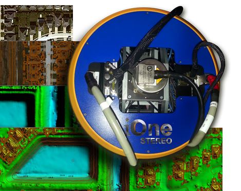
“With the iOne Sensor Reconfiguration Kit, we empower our users to be able to economically grow beyond traditional commercial mapping into the emerging oblique and 3D markets at much lower cost than with any other digital aerial camera. Our vision and value proposition mantra of ‘Collect More. Do More. For Less.’ is based on the belief that time, cost and quality can be balanced when doing geoimaging projects. We challenge the tradeoffs users are often forced to make when it comes to choosing a digital aerial sensor to do a project. The iOne SRK gives companies a robust, multi-purpose, sensor solution that is highly flexible while also performing faster and better at lower cost. We empower our customers with ONE reliable end-to-end digital geoimaging sensor system solution for MANY applications; to grow their business, enhance their products and minimize their risk. A great example of that is how we enable companies to easily, cost-effectively configure their LiDAR systems with a medium format camera by using the iOne IMS Co-mounted and Co-registered (CoCo™) with the LiDAR system. The flexible foundation of iOne systems enables customers to do so much more for less,” added Guevara.
To learn more about the iOne SRK and Visual Intelligence’s flexible iOne sensor system solutions, visit the company this month at the ILMF conference on February 17-19, 2014 in Denver, Colorado.
About Visual Intelligence
Founded in Houston, Texas in 2003, Visual Intelligence LP is an industry-leading software and sensor technology company that delivers world-class geoimaging solutions for airborne, terrestrial and mobile applications. The company has a rich history of industry innovations, numerous Patents, the USGS Digital Aerial Sensor Type Certification, and the 2013 Geospatial Forum World Technology Innovation in Sensors Award. Using the iOne™ Software Sensor Tool Kit Architecture, the company delivers to the geospatial marketplace the iOne™ family of Sensor System Solutions—the most economical, highest performance, most reliable, modular and scalable family of oblique/3D and engineering mapping multipurpose geoimaging sensors. They include automated 2D/3D software workflows for high speed actionable information product generation. For more information, please visit www.visualintell.com.