GIS user technology news

News, Business, AI, Technology, IOS, Android, Google, Mobile, GIS, Crypto Currency, Economics

  • Advertising & Sponsored Posts
    • Advertising & Sponsored Posts
    • Submit Press
  • PRESS
    • Submit PR
    • Top Press
    • Business
    • Software
    • Hardware
    • UAV News
    • Mobile Technology
  • FEATURES
    • Around the Web
    • Social Media Features
    • EXPERTS & Guests
    • Tips
    • Infographics
  • Blog
  • Events
  • Shop
  • Tradepubs
  • CAREERS
You are here: Home / News / Earth Imagery / Tournament Earth 2014: Which Image Will Win It?

Tournament Earth 2014: Which Image Will Win It?

March 5, 2014 By Editor

Thirty-two have been called, but which will be chosen? NASA’s Earth Observatory is hosting the second annual Tournament Earth, a reader-driven competition to choose the previous year’s top NASA image of our planet.

The tournament starts March 3 and ends on April 7, with five rounds of voting spread across five weeks. Images in the competition are a blend of reader and staff favorites from the 2013 calendar year. The images are seeded and divided into four brackets categorized by image type – data visualization, photographs, art and events.

The top seed in the data visualization bracket — and the No. 1 seed overall — is a global map of fine particulate pollution that garnered more than 150,000 page views in 2013. The photo section is topped by a nighttime view of Liege, Belgium, as photographed by an astronaut on the International Space Station. The "art" section is led by a satellite image of a rare snowfall in Great Britain. The top seed among natural events is a January 2013 satellite image of a smog and pollution over China — the second most popular image on the Earth Observatory last year. Six of the seven most-viewed images on the site are battling in the events section.

Nearly 60,000 votes were cast in the 2013 tournament, when an image of a submarine volcanic eruption near El Hierro, off the coast of western Africa, emerged as the champion. With heavy support from Canary Islanders, the volcano image soundly defeated a cracking Pine Island Glacier in the final. El Hierro also wiped out a map of the world’s night lights in the semifinals. The Canary Islands are making a return trip to the tournament in 2014, landing the No. 2 seed in the art bracket. Pine Island Glacier also returns, as the No. 3 seed in the event section.

Every day is Earth Day at the NASA Earth Observatory, which publishes an image-based story 365 days a year, along with feature articles, natural hazards imagery, blog posts, slide shows and global maps of environmental data. More than 6.5 million unique visitors viewed the Earth Observatory in 2013, and 1.7 million people now follow it on Facebook.

On April 29, 2014, the site will celebrate its 15th anniversary as a flagship for NASA Earth science on the web. NASA’s Earth Observatory is perhaps best known for publishing The Blue Marble and The Black Marble (Earth at Night) high-resolution images of our planet, as well as the World of Change series depicting environmental changes over time.
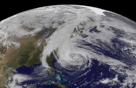
hurricane sandy 

To vote in Tournament Earth, go to:

http://earthobservatory.nasa.gov/TournamentEarth/

For a printable Tournament Earth bracket, go to:

http://earthobservatory.nasa.gov/TournamentEarth/tournament_earth_grid.pdf

NASA Earth Observatory:

http://earthobservatory.nasa.gov


Filed Under: Earth Imagery Tagged With: News, R/S & Earth Imaging, Tournament Earth 2014: Which Image Will Win It?

About Editor

Glenn is a geographer and a GIS professional with over 20 years experience in the industry. He's the co-founder of GISuser and several other technology web publications.

Top Press

The Global Expansion of Aueshah: A New Era of High Jewelry

April 11, 2026 By GISuser

KARACHI, PAKISTAN. The international luxury market is experiencing a profound shift. Consumers are increasingly rejecting mass-produced goods in favor of rarity, authenticity, and emotional depth. … [Read More...]

State of Data Science Report – AI and Open Source at Work

September 10, 2025 By GISuser

AI and Open Source at Work … [Read More...]

Topcon Announces Landmark Expansion of Topnet Live Network Across USA

January 26, 2025 By GISuser

LIVERMORE, Calif.---Topcon Positioning Systems has announced a significant expansion of its Topnet Live reference station network, introducing 200 new geodetic stations strategically positioned across … [Read More...]

Space Flight Laboratory (SFL) Announces Launch and Deployment of NorSat-4 Maritime Monitoring Microsatellite

January 19, 2025 By GISuser

Seventh Satellite Developed by SFL for Norway … [Read More...]

HERE and BMW Group extend partnership on AI-powered mapping system

January 8, 2025 By GISuser

HERE and BMW Group extend partnership on AI-powered mapping system for automated driving and enhanced road safety … [Read More...]

Everest Base Camp Helicopter Tour, Helicopter Return Trek, and Manaslu Circuit Trek: Which Nepal Adventure Is Right for You?

November 6, 2026 By GISuser

Almost everyone planning a Nepal trip runs into the same wall. You want the big mountains, you have a fixed number of days, and every itinerary you read seems to promise something … [Read More...]

SFL Missions Inc. Confirms Successful Deployment of Six HawkEye 360 Radio Frequency Detection Satellites with Advanced Capabilities

October 27, 2026 By GISuser

MĀHIA, New Zealand, 26 October 2026 – SFL Missions Inc. today confirmed the successful deployment of six radio frequency (RF) detection and geolocation satellites for HawkEye 360 … [Read More...]

Canadian-Built RoadEng 12 Uses AI to Find the Best Location for New Resource and Rural Roads

October 17, 2026 By GISuser

Vancouver, BC, Canada, October 15, 2026 – North Vancouver-based Softree Technical Systems today released RoadEng Version 12, used in more than 75 countries to locate and design … [Read More...]

Beyond the Map: How AI Image and Video Generation Is Changing Geospatial Communication

October 14, 2026 By GISuser

Ask anyone who has shipped a GIS project what the hardest part was, and the answer is rarely the spatial analysis. It is almost always the communication. A site suitability … [Read More...]

From Maternity to Everyday Wear: Building a Wardrobe That Grows With You

October 14, 2026 By GISuser

When I think about maternity clothing, I feel the biggest mistake is buying too many things at once. During pregnancy, your body keeps changing, and something that fits well today … [Read More...]

Copyright gletham Communications 2015 - 2026

Go to mobile version