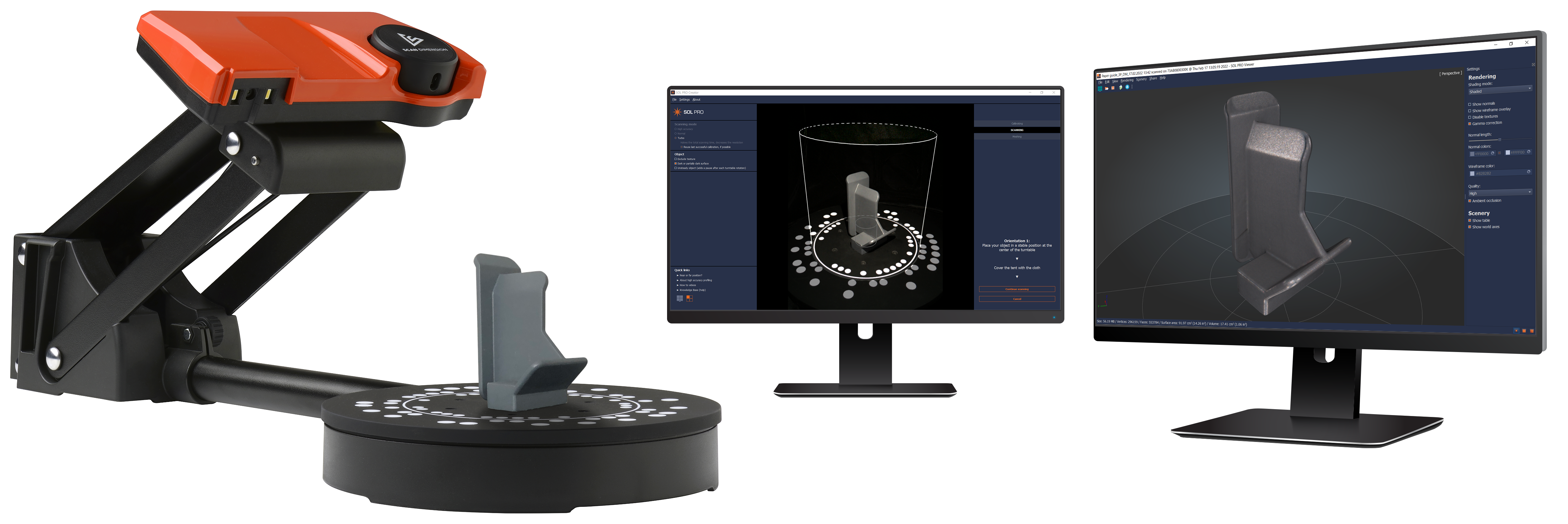
Automated calculations, ability to handle dark objects make SOL PRO a top pick for 3D scanning and inspectionAllerod, Denmark — February 22, 2022 — Scan Dimension, developer of 3D scanning solutions, announces that its SOL PRO scanning software solution has received a significant upgrade. SOL PRO Creator and SOL PRO Viewer for Scan Dimension’s professional-level 3D scanner already let users achieve top-quality 3D scanning results with minimal user intervention. The following new features make the process of scanning and inspecting objects even more powerful:
- The software now calculates the volume and surface area of the scanned object, which gives users instant results for inspection.
- The new option to ‘Exclude texture’ on a scan also reduces total scanning time by 15%.
- After calibration, the software displays the outlines of two cylinders on the turntable, indicating the recommended minimum and maximum object size.
Several features have also been improved:
- SOL PRO 3D scanner makes it possible to scan dark or partially dark objects, which other 3D software cannot achieve. With this upgrade, the noise reduction process behind the dark mode option now removes even more unwanted artifacts.
- SOL PRO Creator offers users a choice of 3 scanning modes: high accuracy (up to 0.05 mm), normal, or turbo (faster). Profiles created for the high accuracy scanning mode now also improve the accuracy of turbo.
“With this software upgrade, SOL PRO becomes even easier to use and more powerful for inspection. These improvements will keep SOL PRO at the forefront of the 3D scanner market in terms of ease of use and quality of results,” comments Jacob Bendix, Chief Commercial Officer, Scan Dimension.
SOL PRO Creator and SOL PRO Viewer software are designed exclusively for SOL PRO, one of the most accurate 3D desktop scanners in its class for product inspection of volume, surface area, shape, and size with metrology-grade accuracy. The easy-to-use software automates the entire 3D scanning process, utilizing a combination of true laser space conversion and white-light technology to achieve effortless, high-quality results, making SOL PRO a perfect partner for inspection, quality assurance, prototyping, and reverse engineering.
For more information on where to buy or how to become a Scan Dimension distributor, email us at contact@scandimension.com.
About Scan Dimension
Scan Dimension is a division of Global Scanning A/S, a Denmark-based market leader with 30+ years of experience in imaging technologies that boasts such top brands as Contex and Colortrac. Visit www.scandimension.com for more information.